
Magnitude |
:3.7 |
| Date & Time (UTC) | 2011-04-11 02:12:51.2 |
| Date & Time (Local) | 1390/1/22 06:42:51.2 |
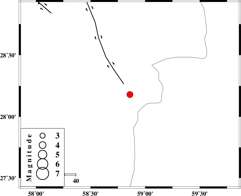
| Location | Lat:28.18 Lon: 58.86 |
| Region | Kerman Province, 117 km North-East of Kahnuj |
Nearest Cities |
|
| 38 km North East of Borj-e abbasabad, Kerman Province | |
| 59 km South of Mohammadabad-e gonbaki, Kerman Province | |
| 61 km South West of Hoseynabad, Kerman Province | |
| 70 km South East of Mardehak, Kerman Province | |
| 77 km South of Void, Kerman Province | |
| Depth | 14 km |
| Agency | |
Faults within 150 km: |
|
| BAM_F (Length: 118 km) , Distance to epicenter: 11 km | |
| GOWK_F (Length: 152 km) , Distance to epicenter: 102 km | |
| JIROFT_F (Length: 144 km) , Distance to epicenter: 107 km | |
| Number of Phases | 5 |
| RMS | 0 |
| Number of Stations | 4 |
| Error in Latitude | >4 km |
| Error in Longitude | 2.7 km |
| Error in Depth | 6.4 km |
Download waveform in seisan format
to download seisan software Click here
to access information about IIEES stations Click here
Amplitude | ||||||||
| UID | Agency | Station | Component | Amplitude | Period | Arrival Time | Proccessing Time | Signal Clip |
| 78668 | IIEES | BNDS | N | 365.2 | 0.52 | 2011-04-11 02:14:14 | 2011-04-11 03:20:00 | n |
| 78669 | IIEES | BNDS | E | 339.8 | 0.48 | 2011-04-11 02:14:16 | 2011-04-11 03:20:00 | n |
| 78670 | IIEES | KRBR | E | 275.2 | 0.68 | 2011-04-11 02:14:18 | 2011-04-11 03:20:00 | n |
| 78671 | IIEES | KRBR | N | 256.4 | 0.68 | 2011-04-11 02:14:29 | 2011-04-11 03:20:00 | n |
Phase | ||||||||||||
| Agency | Station | Component | Phase Type | Phase Quality | First Motion | Observed Arrival Time | Time Residual | Loc. Flag | Input Weight | Distance | Azimuth | |
| IIEES | ZHSF | Z | P | E | 2011-04-11 02:13:29 | 0 | y | 245 | 49 | |||
| IIEES | ZHSF | E | Sg | E | 2011-04-11 02:14:00 | 0 | y | 245 | 49 | |||
| IIEES | BNDS | Z | P | E | 2011-04-11 02:13:33 | 0 | y | 279 | 252 | |||
| IIEES | KRBR | Z | P | E | 2011-04-11 02:13:34 | 0 | y | 286 | 315 | |||
| IIEES | GHIR | Z | P | E | 2011-04-11 02:14:10 | -0.1 | y | 577 | 272 | |||