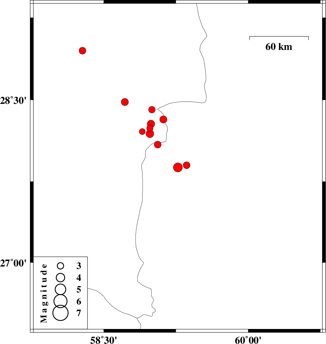
| Prel. Rep. | Date | Time(UTC) | Time(Local) | Lat. | Lon. | Depth | Mag. | Region | Waveform |
|
|
2011/03/21
|
11:01:12.5
|
14:31:12.5
| 27.9 | 59.36 | 18 |
ML:3.2
|
Sistan va Baloochestan Province, 163 km East of Kahnuj | |
|
|
2011/03/21
|
06:02:22.5
|
09:32:22.5
| 27.88 | 59.27 | 18 |
ML:4.2
|
Sistan va Baloochestan Province, 155 km East of Kahnuj | |
|
|
2011/03/19
|
23:24:09.5
|
02:54:09.5
| 28.41 | 59 | 15 |
ML:3.1
|
Kerman Province, 100 km South-East of Bam | |
|
|
2011/03/07
|
01:44:07.9
|
05:14:07.9
| 28.48 | 58.72 | 18 |
ML:3.4
|
Kerman Province, 78 km South-East of Bam | |
|
|
2011/03/06
|
00:33:53.8
|
04:03:53.8
| 28.32 | 59.12 | 18 |
ML:3.4
|
Kerman Province, 114 km South-East of Bam | |
|
|
2011/03/02
|
00:40:08.7
|
04:10:08.7
| 28.95 | 58.28 | 14 |
ML:3.3
|
Kerman Province, 19 km South of Bam | |
|
|
2011/02/28
|
21:30:07.3
|
01:00:07.3
| 28.24 | 58.98 | 14 |
ML:3
|
Kerman Province, 114 km South-East of Bam | |
|
|
2011/02/25
|
02:46:25.5
|
06:16:25.5
| 28.21 | 58.9 | 18 |
ML:2.8
|
Kerman Province, 113 km South-East of Bam | |
|
|
2011/02/24
|
03:36:18.0
|
07:06:18.0
| 28.19 | 58.98 | 18 |
ML:3.6
|
Kerman Province, 129 km North-East of Kahnuj | |
|
|
2011/02/21
|
04:23:47.6
|
07:53:47.6
| 28.09 | 59.06 | 14 |
ML:3.3
|
Sistan va Baloochestan Province, 135 km North-East of Kahnuj | |
|
|
2011/02/19
|
01:07:27.5
|
04:37:27.5
| 28.28 | 58.99 | 14 |
ML:3.5
|
Kerman Province, 111 km South-East of Bam | |
