
Magnitude |
:4.2 |
| Date & Time (UTC) | 2011-03-21 06:02:22.5 |
| Date & Time (Local) | 1390/1/1 09:32:22.5 |
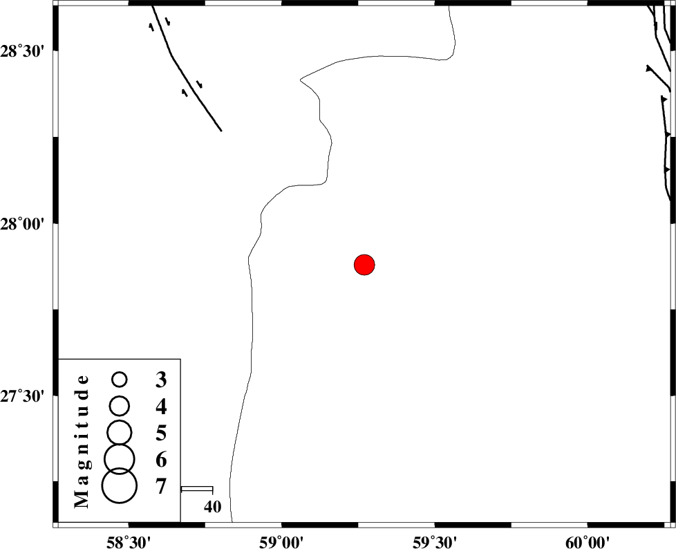
| Location | Lat:27.88 Lon: 59.27 |
| Region | Sistan va Baloochestan Province, 155 km East of Kahnuj |
Nearest Cities |
|
| 50 km North West of Kalemursi, Sistan va Baloochestan Province | |
| 76 km South East of Borj-e abbasabad, Kerman Province | |
| 89 km North West of Bozman, Sistan va Baloochestan Province | |
| 92 km West of Kiman, Sistan va Baloochestan Province | |
| 94 km South East of Hoseynabad, Kerman Province | |
| Depth | 18 km |
| Agency | |
Faults within 150 km: |
|
| BAM_F (Length: 118 km) , Distance to epicenter: 63 km | |
| KASKIN_F (Length: 100 km) , Distance to epicenter: 100 km | |
| S_JAZMURIAN_F (Length: 91 km) , Distance to epicenter: 107 km | |
| Number of Phases | 6 |
| RMS | 0.3 |
| Number of Stations | 7 |
| Error in Latitude | >5.8 km |
| Error in Longitude | 8.6 km |
| Error in Depth | 19 km |
Download waveform in seisan format
to download seisan software Click here
to access information about IIEES stations Click here
Amplitude | ||||||||
| UID | Agency | Station | Component | Amplitude | Period | Arrival Time | Proccessing Time | Signal Clip |
| 78377 | IIEES | BNDS | E | 558.5 | 0.51 | 2011-03-21 06:04:03 | 2011-03-21 07:18:00 | n |
| 78378 | IIEES | BNDS | N | 655.9 | 0.74 | 2011-03-21 06:04:06 | 2011-03-21 07:18:00 | n |
| 78379 | IIEES | KRBR | E | 451.3 | 0.75 | 2011-03-21 06:04:19 | 2011-03-21 07:18:00 | n |
| 78380 | IIEES | TABS | N | 155.6 | 0.7 | 2011-03-21 06:05:37 | 2011-03-21 07:18:00 | n |
| 78381 | IIEES | TABS | E | 95 | 0.65 | 2011-03-21 06:05:43 | 2011-03-21 07:18:00 | n |
Phase | ||||||||||||
| Agency | Station | Component | Phase Type | Phase Quality | First Motion | Observed Arrival Time | Time Residual | Loc. Flag | Input Weight | Distance | Azimuth | |
| IIEES | ZHSF | Z | Pn | E | 2011-03-21 06:03:00 | 0.3 | y | 242 | 37 | |||
| IIEES | CHBR | Z | Pn | E | 2011-03-21 06:03:04 | -0.4 | y | 280 | 154 | |||
| IIEES | CHBR | E | Sg | E | 2011-03-21 06:03:41 | 0.2 | y | 280 | 154 | |||
| IIEES | KRBR | Z | Pn | E | 2011-03-21 06:03:12 | 0 | y | 338 | 314 | |||
| IIEES | SHRT | Z | Pn | E | 2011-03-21 06:03:49 | -0.4 | y | 647 | 8 | |||
| IIEES | NASN | Z | Pn | E | 2011-03-21 06:04:13 | 0.6 | y | 826 | 313 | |||