
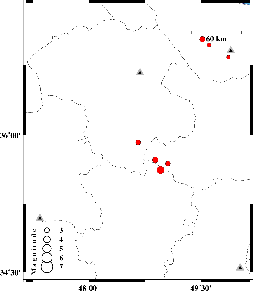
| Prel. Rep. | Date | Time(UTC) | Time(Local) | Lat. | Lon. | Depth | Mag. | Region | Waveform |
| 2004/10/29 | 11:53:40.0 | 15:23:40.0 | 35.92 | 48.66 | 14 | ML:2.9 | 23 km South of Qeydar, Zanjan Province | ||
| 2004/10/27 | 00:49:28.5 | 04:19:28.5 | 35.73 | 48.89 | 14 | ML:3.5 | 40 km North-West of Razan, Hamedan Province | ||
| 2004/10/17 | 21:31:02.7 | 01:01:02.7 | 35.62 | 48.96 | 17 | ML:4.5 | 26 km North of Razan, Hamedan Province | ||
| 2004/10/06 | 22:23:12.4 | 01:53:12.4 | 37.03 | 49.52 | 14 | ML:3.4 | 18 km South-East of Shaft, Gilan Province | ||
| 2004/10/05 | 16:39:23.4 | 20:09:23.4 | 35.69 | 49.06 | 14 | ML:2.9 | 34 km North of Razan, Hamedan Province | ||
| 2004/10/05 | 12:10:51.2 | 15:40:51.2 | 36.97 | 49.61 | 14 | ML:2.4 | 23 km North-East of Rudbar, Gilan Province | ||
| 2004/10/01 | 07:32:09.6 | 11:02:09.6 | 36.84 | 49.87 | 14 | ML:2.3 | 33 km South of Siahkal, Gilan Province |