
Magnitude |
:2.9 |
| Date & Time (UTC) | 2004-10-05 16:39:23.4 |
| Date & Time (Local) | 1383/7/14 20:09:23.4 |
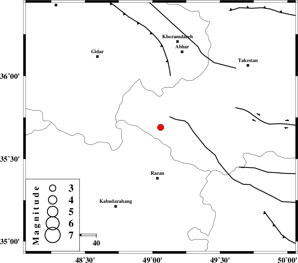
| Location | Lat:35.69 Lon: 49.06 |
| Region | 34 km North of Razan, Hamedan Province |
Nearest Cities |
|
| 20 km North West of Avaj, Ghazvin Province | |
| 22 km West of Ab-e garm, Ghazvin Province | |
| 31 km North East of Khorandeh, Hamedan Province | |
| 34 km North of Razan, Hamedan Province | |
| 34 km North East of Kahla, Zanjan Province | |
| Depth | 14 km |
| Agency | |
Faults within 150 km: |
|
| KUSHK_E_NOSRAT_F (Length: 230 km) , Distance to epicenter: 9 km | |
| SOLTANIYEH_F (Length: 119 km) , Distance to epicenter: 35 km | |
| IPAK_F (Length: 80 km) , Distance to epicenter: 52 km | |
| Number of Phases | 7 |
| RMS | 0.2 |
| Number of Stations | 4 |
| Error in Latitude | >3.7 km |
| Error in Longitude | 2.3 km |
| Error in Depth | 9.4 km |
Download waveform in seisan format
to download seisan software Click here
to access information about IIEES stations Click here
Amplitude | ||||||||
| UID | Agency | Station | Component | Amplitude | Period | Arrival Time | Proccessing Time | Signal Clip |
| 30396 | IIEES | THKV | E | 163.9 | 0.59 | 2004-10-05 16:40:16 | 2006-03-15 11:56:00 | n |
| 30397 | IIEES | THKV | N | 109.6 | 0.61 | 2004-10-05 16:40:20 | 2006-03-15 11:56:00 | n |
| 30398 | IIEES | DAMV | E | 65.7 | 0.46 | 2004-10-05 16:40:42 | 2006-03-15 11:56:00 | n |
| 30399 | IIEES | DAMV | N | 66.6 | 0.6 | 2004-10-05 16:40:45 | 2006-03-15 11:56:00 | n |
Phase | ||||||||||||
| Agency | Station | Component | Phase Type | Phase Quality | First Motion | Observed Arrival Time | Time Residual | Loc. Flag | Input Weight | Distance | Azimuth | |
| IIEES | ASAO | Z | PG | E | 2004-10-05 16:39:48 | -0.3 | y | 155 | 145 | |||
| IIEES | ASAO | N | SG | E | 2004-10-05 16:40:08 | 0.1 | y | 155 | 145 | |||
| IIEES | THKV | Z | PG | E | 2004-10-05 16:39:50 | -0.3 | y | 166 | 81 | |||
| IIEES | THKV | N | SG | E | 2004-10-05 16:40:11 | 0.2 | y | 166 | 81 | |||
| IIEES | SNGE | Z | PG | E | 2004-10-05 16:39:51 | -0.2 | y | 169 | 247 | |||
| IIEES | SNGE | N | SG | E | 2004-10-05 16:40:12 | 0.2 | y | 169 | 247 | |||
| IIEES | DAMV | Z | PN | E | 2004-10-05 16:40:04 | 0.2 | y | 264 | 91 | |||