
| Prel. Rep. | Date | Time(UTC) | Time(Local) | Lat. | Lon. | Depth | Mag. | Region | Waveform |
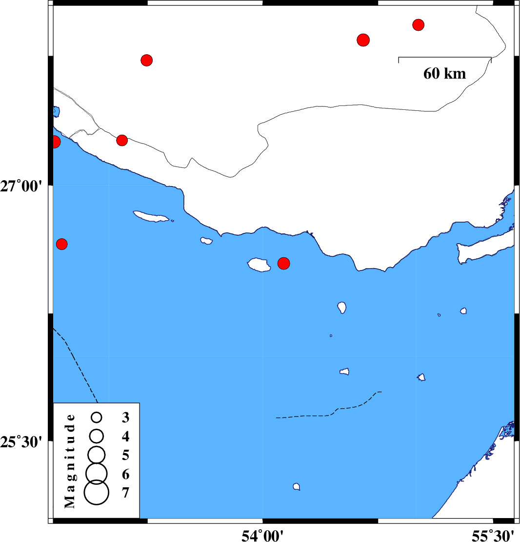
| 2025/09/10 | 07:20:02.6 | 10:50:02.6 | 26.543 | 54.136 | 12 | ML:3.5 | Persian Gulf, 71 km -West of Bandar-e lengeh | ||
| 2025/09/03 | 08:45:33.3 | 12:15:33.3 | 27.252 | 52.643 | 12 | ML:3.6 | Persian Gulf, 41 km South-West of Mehr | ||
| 2025/09/02 | 16:05:42.3 | 19:35:42.3 | 27.725 | 53.244 | 12 | ML:3.4 | Fars Province, 44 km North of Lamerd | ||
| 2025/08/29 | 21:12:54.3 | 00:42:54.3 | 26.656 | 52.692 | 12 | ML:3.3 | Persian Gulf | ||
| 2025/08/22 | 07:15:02.8 | 10:45:02.8 | 27.93 | 55.013 | 12 | ML:3.4 | Fars Province, 72 km North-East of Lar | ||
| 2025/08/17 | 10:46:30.9 | 14:16:30.9 | 27.842 | 54.654 | 12 | ML:3.7 | Fars Province, 36 km North-East of Lar | ||
| 2025/08/16 | 23:43:47.0 | 03:13:47.0 | 27.261 | 53.084 | 10 | ML:3.3 | Hormozgan Province, 11 km of Lamerd |