
Magnitude |
:3.3 |
| Date & Time (UTC) | 2025-08-16 23:43:47.0 |
| Date & Time (Local) | 1404/5/26 03:13:47.0 |
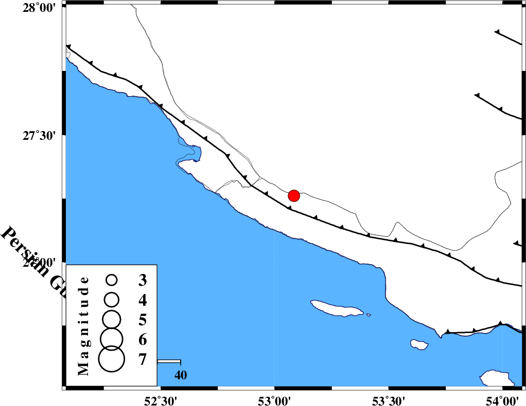
| Location | Lat:27.261 Lon: 53.084 |
| Region | Hormozgan Province, 11 km of Lamerd |
Nearest Cities |
|
| 11 km of Lamerd, Fars Province | |
| 23 km South East of Khoozi, Fars Province | |
| 31 km East of Chah-e mobarak, Bushehr Province | |
| 37 km South East of Mehr, Fars Province | |
| 42 km South East of Alamarvdasht, Fars Province | |
| Depth | 10 km |
| Agency | |
Faults within 150 km: |
|
| MFF3 (Length: 292 km) , Distance to epicenter: 6 km | |
| ZFF1 (Length: 165 km) , Distance to epicenter: 89 km | |
| LAR_F (Length: 99 km) , Distance to epicenter: 90 km | |
| Number of Phases | 8 |
| RMS | 0.6 |
| Number of Stations | 8 |
| Error in Latitude | >2.2 km |
| Error in Longitude | 2.2 km |
| Error in Depth | 13.5 km |
Download waveform in seisan format
to download seisan software Click here
to access information about IIEES stations Click here
Amplitude | ||||||||
| UID | Agency | Station | Component | Amplitude | Period | Arrival Time | Proccessing Time | Signal Clip |
| 198871 | IIEES SC | KRBR | Z | 0.05 | 1 | 2025-08-16 23:44:53 | 2025-08-18 07:59:00 | n |
| 198872 | IIEES SC | IRSR | Z | 0.006 | 1 | 2025-08-16 23:45:30 | 2025-08-18 07:59:00 | n |
| 198873 | IIEES SC | TABS | Z | 0.008 | 1 | 2025-08-16 23:45:34 | 2025-08-18 07:59:00 | n |
| 198874 | IIEES SC | ASAO | Z | 0.01 | 1 | 2025-08-16 23:45:41 | 2025-08-18 07:59:00 | n |
Phase | ||||||||||||
| Agency | Station | Component | Phase Type | Phase Quality | First Motion | Observed Arrival Time | Time Residual | Loc. Flag | Input Weight | Distance | Azimuth | |
| IIEES SC | GHIR | Z | EPg | E | 2025-08-16 23:44:07 | 0.8 | y | 0 | 114 | 355 | ||
| IIEES SC | UOSS | Z | EPn | E | 2025-08-16 23:44:45 | 0.4 | y | 0 | 404 | 129 | ||
| IIEES SC | KRBR | Z | EPn | E | 2025-08-16 23:44:53 | -0.1 | y | 0 | 469 | 50 | ||
| IIEES SC | YZKH | Z | EPn | E | 2025-08-16 23:44:39 | -28.9 | n | 4 | 587 | 14 | ||
| IIEES SC | IRSR | Z | EPn | E | 2025-08-16 23:45:30 | -0.9 | y | 0 | 772 | 92 | ||
| IIEES SC | TABS | Z | EPn | E | 2025-08-16 23:45:34 | -1 | y | 0 | 807 | 29 | ||
| IIEES SC | ASAO | Z | EPn | E | 2025-08-16 23:45:41 | -1 | y | 0 | 859 | 340 | ||
| IIEES SC | RAYN | Z | EPn | E | 2025-08-16 23:45:42 | -0.3 | y | 0 | 868 | 242 | ||