
Magnitude |
:3.7 |
| Date & Time (UTC) | 2025-08-17 10:46:30.9 |
| Date & Time (Local) | 1404/5/26 14:16:30.9 |
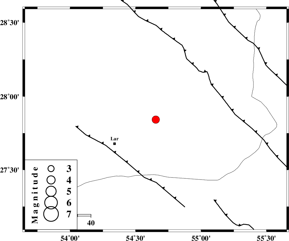
| Location | Lat:27.842 Lon: 54.654 |
| Region | Fars Province, 36 km North-East of Lar |
Nearest Cities |
|
| 23 km East of Dehkuyeh, Fars Province | |
| 31 km North East of Latifi, Fars Province | |
| 36 km North East of Lar, Fars Province | |
| 53 km North East of Grash, Fars Province | |
| 61 km South East of Shahr-e pir, Fars Province | |
| Depth | 12 km |
| Agency | |
Faults within 150 km: |
|
| BERIZ_F (Length: 49 km) , Distance to epicenter: 24 km | |
| LAR_F (Length: 99 km) , Distance to epicenter: 27 km | |
| HZF2 (Length: 437 km) , Distance to epicenter: 56 km | |
| Number of Phases | 6 |
| RMS | 0.1 |
| Number of Stations | 6 |
| Error in Latitude | >2.7 km |
| Error in Longitude | 2.7 km |
| Error in Depth | 16.8 km |
Download waveform in seisan format
to download seisan software Click here
to access information about IIEES stations Click here
Amplitude | ||||||||
| UID | Agency | Station | Component | Amplitude | Period | Arrival Time | Proccessing Time | Signal Clip |
| 198875 | IIEES SC | KRBR | Z | 0.6 | 1 | 2025-08-17 10:47:18 | 2025-08-18 09:00:00 | n |
| 198876 | IIEES SC | NASN | Z | 0.04 | 1 | 2025-08-17 10:47:51 | 2025-08-18 09:00:00 | n |
| 198877 | IIEES SC | ASAO | Z | 0.02 | 1 | 2025-08-17 10:48:25 | 2025-08-18 09:00:00 | n |
Phase | ||||||||||||
| Agency | Station | Component | Phase Type | Phase Quality | First Motion | Observed Arrival Time | Time Residual | Loc. Flag | Input Weight | Distance | Azimuth | |
| IIEES SC | GHIR | Z | EPg | E | 2025-08-17 10:46:59 | 0 | y | 0 | 171 | 287 | ||
| IIEES SC | KRBR | Z | EPn | E | 2025-08-17 10:47:18 | -0.1 | y | 0 | 314 | 41 | ||
| IIEES SC | UOSS | Z | EPn | E | 2025-08-17 10:47:23 | 0 | y | 0 | 356 | 154 | ||
| IIEES SC | NASN | Z | EPn | E | 2025-08-17 10:47:51 | 0.2 | y | 0 | 578 | 342 | ||
| IIEES SC | IRSR | Z | EPn | E | 2025-08-17 10:47:59 | 3.5 | n | 4 | 622 | 99 | ||
| IIEES SC | ASAO | Z | EPn | E | 2025-08-17 10:48:25 | -1.1 | y | 0 | 864 | 329 | ||