
| Prel. Rep. | Date | Time(UTC) | Time(Local) | Lat. | Lon. | Depth | Mag. | Region | Waveform |
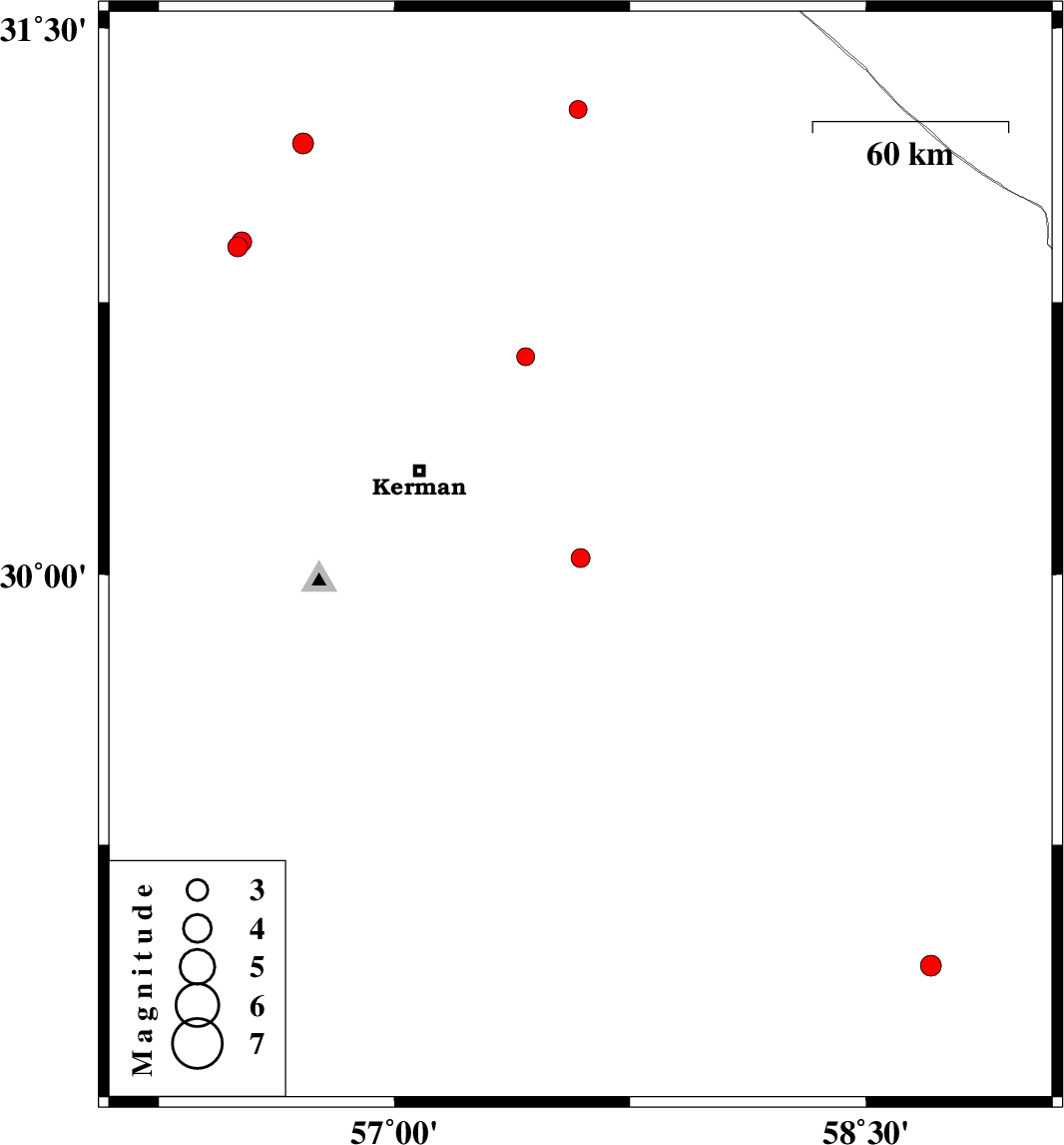
| 2015/11/07 | 17:12:22.5 | 20:42:22.5 | 30.046 | 57.592 | 6 | ML:2.7 | Kerman Province, 56 km South-East of Kerman | ||
| 2015/11/05 | 16:00:58.5 | 19:30:58.5 | 31.279 | 57.585 | 14 | ML:2.5 | Kerman Province, 73 km -East of Ravar | ||
| 2015/11/04 | 10:04:23.9 | 13:34:23.9 | 31.186 | 56.71 | 18 | ML:3 | Kerman Province, 13 km -West of Ravar | ||
| 2015/11/03 | 23:20:31.5 | 02:50:31.5 | 30.601 | 57.417 | 14 | ML:2.6 | Kerman Province, 48 km North-East of Kerman | ||
| 2015/11/02 | 00:27:59.3 | 03:57:59.3 | 30.903 | 56.501 | 14 | ML:2.8 | Kerman Province, 12 km of Zarand | ||
| 2015/10/31 | 20:52:16.7 | 00:22:16.7 | 30.916 | 56.514 | 14 | ML:2.8 | Kerman Province, 13 km North of Zarand | ||
| 2015/10/31 | 17:12:59.8 | 20:42:59.8 | 28.913 | 58.706 | 14 | ML:3 | Kerman Province, 40 km South-East of Bam |