
Magnitude |
:3 |
| Date & Time (UTC) | 2015-10-31 17:12:59.8 |
| Date & Time (Local) | 1394/8/9 20:42:59.8 |
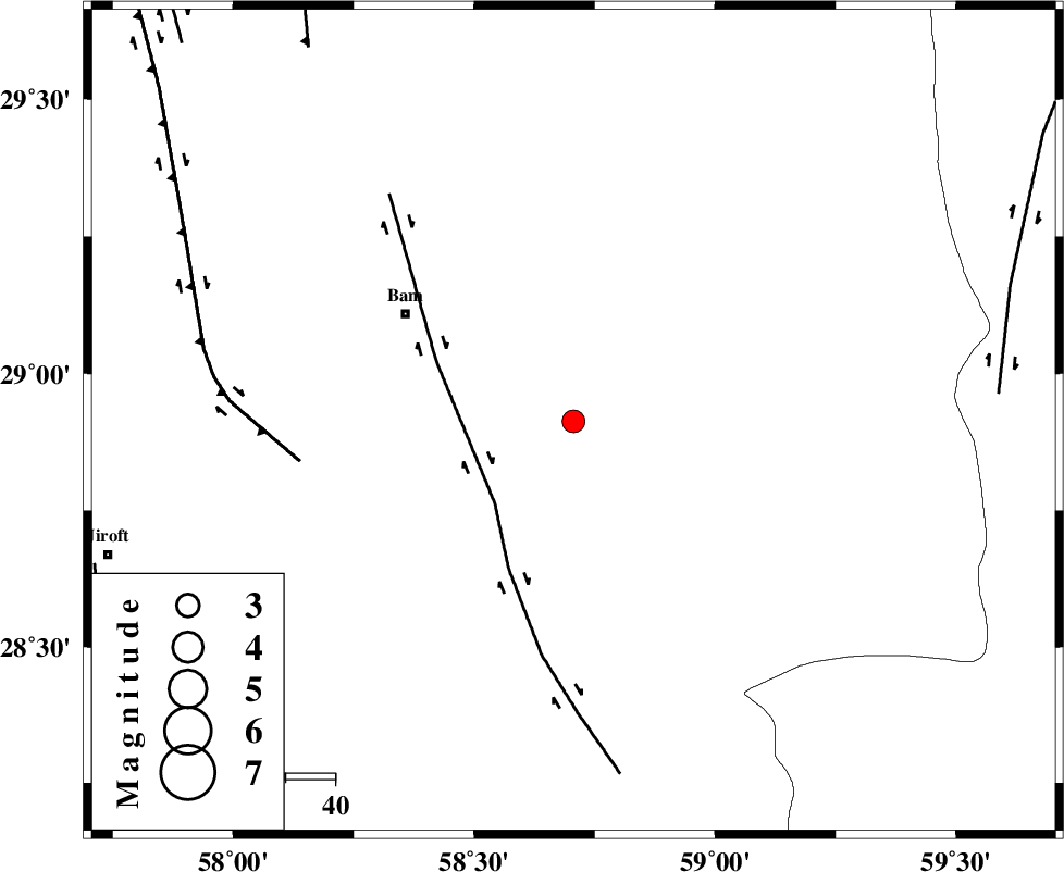
| Location | Lat:28.913 Lon: 58.706 |
| Region | Kerman Province, 40 km South-East of Bam |
Nearest Cities |
|
| 8 km of Qasemabad, Kerman Province | |
| 13 km East of Abshur-e nezamabad, Kerman Province | |
| 19 km West of Fahroj, Kerman Province | |
| 19 km North West of Void, Kerman Province | |
| 24 km North East of Kruk, Kerman Province | |
| Depth | 14 km |
| Agency | |
Faults within 150 km: |
|
| BAM_F (Length: 118 km) , Distance to epicenter: 23 km | |
| GOWK_F (Length: 152 km) , Distance to epicenter: 56 km | |
| KANURAK_F (Length: 135 km) , Distance to epicenter: 86 km | |
| Number of Phases | 5 |
| RMS | 0.1 |
| Number of Stations | 4 |
| Error in Latitude | >6.9 km |
| Error in Longitude | 2.6 km |
| Error in Depth | 7.3 km |
Download waveform in seisan format
to download seisan software Click here
to access information about IIEES stations Click here
Amplitude | ||||||||
| UID | Agency | Station | Component | Amplitude | Period | Arrival Time | Proccessing Time | Signal Clip |
| 102136 | IIEES | KRBR | E | 67.6 | 0.14 | 2015-10-31 17:14:05 | 2015-11-01 10:06:00 | n |
| 102137 | IIEES | BSRN | E | 62.8 | 0.54 | 2015-10-31 17:14:41 | 2015-11-01 10:06:00 | n |
| 102138 | IIEES | BSRN | N | 56.6 | 0.31 | 2015-10-31 17:14:45 | 2015-11-01 10:06:00 | n |
Phase | ||||||||||||
| Agency | Station | Component | Phase Type | Phase Quality | First Motion | Observed Arrival Time | Time Residual | Loc. Flag | Input Weight | Distance | Azimuth | |
| IIEES | ZHSF | Z | Pn | E | 2015-10-31 17:13:34 | -0.11 | y | 215 | 68 | |||
| IIEES | KRBR | Z | Pn | E | 2015-10-31 17:13:35 | 0.09 | y | 223 | 303 | |||
| IIEES | KRBR | N | Sg | E | 2015-10-31 17:14:03 | -0.07 | y | 223 | 303 | |||
| IIEES | BSRN | Z | Pn | E | 2015-10-31 17:13:50 | 0.1 | y | 341 | 7 | |||
| IIEES | YZKH | Z | Pn | E | 2015-10-31 17:14:16 | 0 | y | 551 | 315 | |||