
| Prel. Rep. | Date | Time(UTC) | Time(Local) | Lat. | Lon. | Depth | Mag. | Region | Waveform |
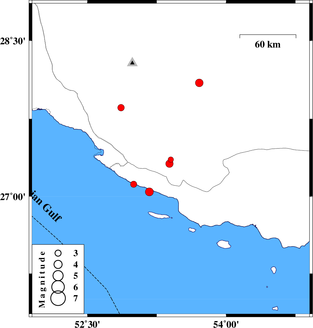
| 2015/10/06 | 23:04:07.1 | 02:34:07.1 | 27.357 | 53.402 | 15 | ML:2.7 | Fars Province, 23 km -East of Lamerd | ||
| 2015/10/06 | 12:14:56.0 | 15:44:56.0 | 27.118 | 53.001 | 14 | ML:3.1 | Persian Gulf, 29 km South-West of Lamerd | ||
| 2015/10/03 | 16:34:50.1 | 20:04:50.1 | 27.044 | 53.171 | 18 | ML:3.9 | Persian Gulf, 32 km South of Lamerd | ||
| 2015/10/01 | 13:23:25.8 | 16:53:25.8 | 27.317 | 53.388 | 15 | ML:3.6 | Fars Province, 22 km -East of Lamerd | ||
| 2015/09/30 | 22:26:37.2 | 01:56:37.2 | 28.096 | 53.71 | 15 | ML:3.8 | Fars Province, 47 km South-East of Jahrom | ||
| 2015/09/29 | 18:58:10.7 | 22:28:10.7 | 27.857 | 52.864 | 14 | ML:3.2 | Fars Province, 35 km North of Mehr |