
Magnitude |
:2.7 |
| Date & Time (UTC) | 2015-10-06 23:04:07.1 |
| Date & Time (Local) | 1394/7/15 02:34:07.1 |
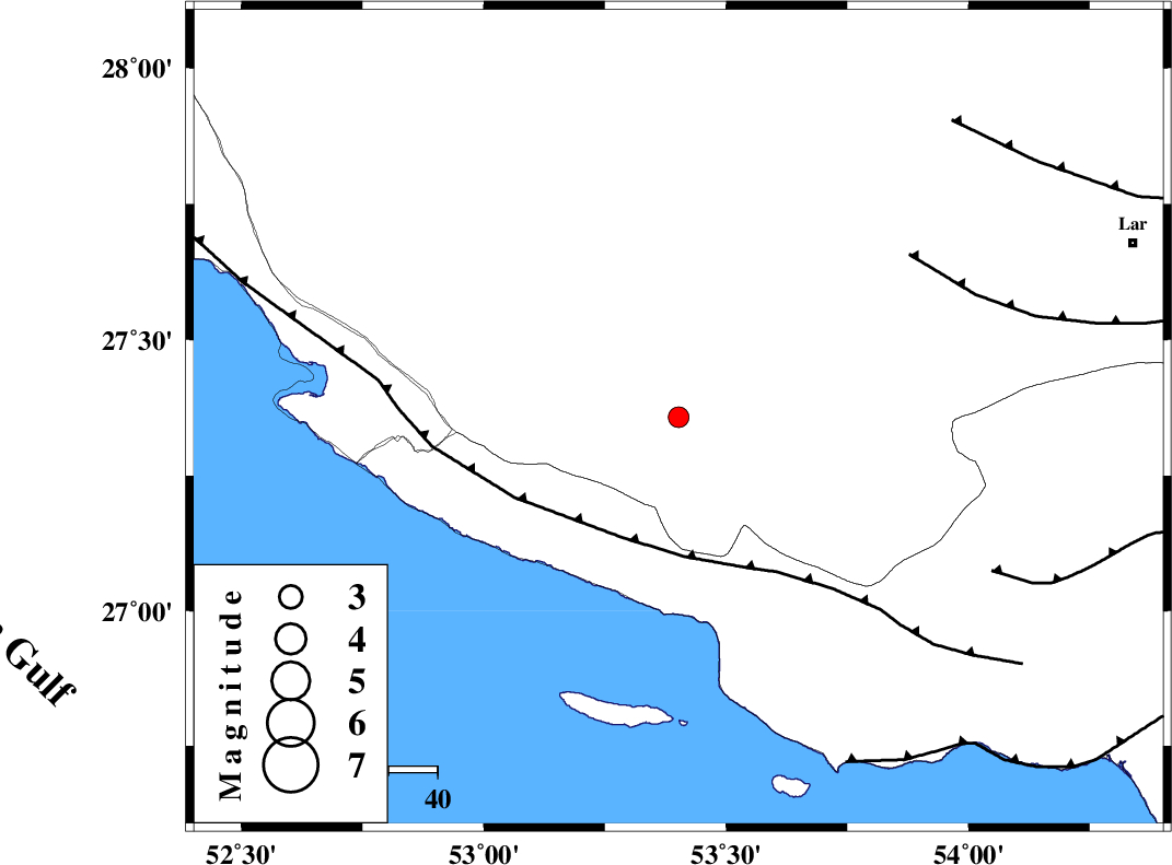
| Location | Lat:27.357 Lon: 53.402 |
| Region | Fars Province, 23 km -East of Lamerd |
Nearest Cities |
|
| 14 km West of Beyram, Fars Province | |
| 23 km North East of Lamerd, Fars Province | |
| 26 km North West of Ashkenan, Fars Province | |
| 28 km South West of Fedagh, Fars Province | |
| 39 km North West of Ahl, Fars Province | |
| Depth | 15 km |
| Agency | |
Faults within 150 km: |
|
| MFF3 (Length: 292 km) , Distance to epicenter: 27 km | |
| LAR_F (Length: 99 km) , Distance to epicenter: 58 km | |
| MFF1 (Length: 180 km) , Distance to epicenter: 71 km | |
| Number of Phases | 6 |
| RMS | 0.2 |
| Number of Stations | 6 |
| Error in Latitude | >5.9 km |
| Error in Longitude | 1.7 km |
| Error in Depth | 0 km |
Download waveform in seisan format
to download seisan software Click here
to access information about IIEES stations Click here
Amplitude | ||||||||
| UID | Agency | Station | Component | Amplitude | Period | Arrival Time | Proccessing Time | Signal Clip |
| 101505 | IIEES | AHRM | E | 32.5 | 0.58 | 2015-10-06 23:05:42 | 2015-10-07 06:02:00 | n |
| 101506 | IIEES | KRBR | E | 7.5 | 0.43 | 2015-10-06 23:06:17 | 2015-10-07 06:02:00 | n |
| 101507 | IIEES | NASN | N | 6.3 | 0.54 | 2015-10-06 23:06:35 | 2015-10-07 06:02:00 | n |
Phase | ||||||||||||
| Agency | Station | Component | Phase Type | Phase Quality | First Motion | Observed Arrival Time | Time Residual | Loc. Flag | Input Weight | Distance | Azimuth | |
| IIEES | AHRM | Z | Pn | E | 2015-10-06 23:04:47 | 0.07 | y | 266 | 309 | |||
| IIEES | BNDS | Z | Pn | E | 2015-10-06 23:04:48 | -0.06 | y | 274 | 88 | |||
| IIEES | KRBR | Z | Pn | E | 2015-10-06 23:05:09 | 0.25 | y | 439 | 48 | |||
| IIEES | YZKH | Z | Pn | E | 2015-10-06 23:05:25 | 0.2 | y | 570 | 11 | |||
| IIEES | NASN | Z | Pn | E | 2015-10-06 23:05:29 | -0.4 | y | 606 | 355 | |||
| IIEES | BSRN | Z | P | E | 2015-10-06 23:05:48 | -0.25 | y | 753 | 46 | |||