
Magnitude |
:3.1 |
| Date & Time (UTC) | 2015-10-06 12:14:56.0 |
| Date & Time (Local) | 1394/7/14 15:44:56.0 |
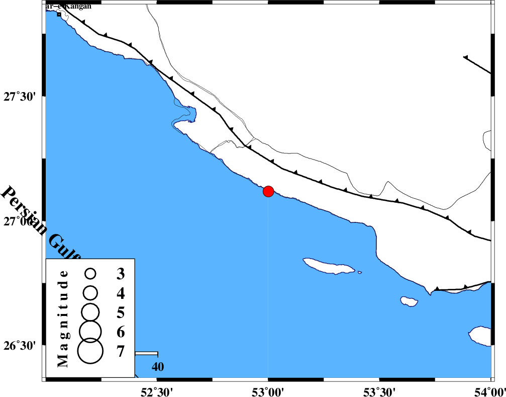
| Location | Lat:27.118 Lon: 53.001 |
| Region | Persian Gulf, 29 km South-West of Lamerd |
Nearest Cities |
|
| 29 km South West of Lamerd, Fars Province | |
| 34 km South East of Chah-e mobarak, Bushehr Province | |
| 37 km South of Khoozi, Fars Province | |
| 49 km South East of Mehr, Fars Province | |
| 55 km South East of Bandar-e asaluyeh, Bushehr Province | |
| Depth | 14 km |
| Agency | |
Faults within 150 km: |
|
| MFF3 (Length: 292 km) , Distance to epicenter: 12 km | |
| ZFF1 (Length: 165 km) , Distance to epicenter: 86 km | |
| MFF1 (Length: 180 km) , Distance to epicenter: 104 km | |
| Number of Phases | 5 |
| RMS | 0.1 |
| Number of Stations | 4 |
| Error in Latitude | >7.4 km |
| Error in Longitude | 3.9 km |
| Error in Depth | 8.2 km |
Download waveform in seisan format
to download seisan software Click here
to access information about IIEES stations Click here
Amplitude | ||||||||
| UID | Agency | Station | Component | Amplitude | Period | Arrival Time | Proccessing Time | Signal Clip |
| 101501 | IIEES | AHRM | E | 167.6 | 0.44 | 2015-10-06 12:16:28 | 2015-10-07 06:02:00 | n |
| 101502 | IIEES | BNDS | E | 69 | 0.5 | 2015-10-06 12:16:29 | 2015-10-07 06:02:00 | n |
| 101503 | IIEES | KRBR | N | 14 | 0.52 | 2015-10-06 12:17:00 | 2015-10-07 06:02:00 | n |
| 101504 | IIEES | KRBR | E | 15 | 0.87 | 2015-10-06 12:17:28 | 2015-10-07 06:02:00 | n |
Phase | ||||||||||||
| Agency | Station | Component | Phase Type | Phase Quality | First Motion | Observed Arrival Time | Time Residual | Loc. Flag | Input Weight | Distance | Azimuth | |
| IIEES | AHRM | Z | Pn | E | 2015-10-06 12:15:35 | -0.12 | y | 256 | 320 | |||
| IIEES | BNDS | Z | Pn | E | 2015-10-06 12:15:43 | 0.07 | y | 315 | 84 | |||
| IIEES | BNDS | N | Sg | E | 2015-10-06 12:16:24 | -0.09 | y | 315 | 84 | |||
| IIEES | KRBR | Z | Pn | E | 2015-10-06 12:16:04 | 0.18 | y | 486 | 48 | |||
| IIEES | YZKH | Z | Pn | E | 2015-10-06 12:16:19 | 0.04 | y | 604 | 14 | |||