| Prel. Rep. | Date | Time(UTC) | Time(Local) | Lat. | Lon. | Depth | Mag. | Region | Waveform |
|
|
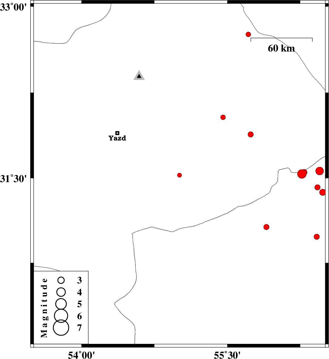
2015/09/08
|
09:55:35.7
|
14:25:35.7
| 31.526 | 55.008 | 6 |
ML:2
|
Yazd Province, 38 km -West of Bafq | |
|
|
2015/09/05
|
09:27:45.4
|
13:57:45.4
| 32.034 | 55.456 | 14 |
ML:2.2
|
Yazd Province, 48 km North of Bafq | |
|
|
2015/09/05
|
09:20:54.4
|
13:50:54.4
| 30.982 | 56.42 | 17 |
ML:2.6
|
Kerman Province, 24 km North-West of Zarand | |
|
|
2015/09/01
|
14:29:29.5
|
18:59:29.5
| 32.757 | 55.716 | 15 |
ML:2.3
|
Yazd Province, 132 km North-East of Bafq | |
|
|
2015/08/29
|
07:45:02.0
|
12:15:02.0
| 31.418 | 56.427 | 14 |
ML:2.6
|
Kerman Province, 40 km North-West of Ravar | |
|
|
2015/08/25
|
06:17:10.8
|
10:47:10.8
| 31.537 | 56.267 | 14 |
ML:4.1
|
Kerman Province, 60 km North-West of Ravar | |
|
|
2015/08/23
|
11:59:11.9
|
16:29:11.9
| 31.551 | 56.291 | 14 |
ML:2.7
|
Kerman Province, 59 km North-West of Ravar | |
|
|
2015/08/23
|
07:13:36.7
|
11:43:36.7
| 31.068 | 55.902 | 14 |
ML:2.6
|
Kerman Province, 74 km North of Rafsanjan | |
|
|
2015/08/22
|
09:13:27.1
|
13:43:27.1
| 31.562 | 56.45 | 14 |
ML:3.6
|
Kerman Province, 48 km North-West of Ravar | |
|
|
2015/08/14
|
07:06:58.5
|
11:36:58.5
| 31.375 | 56.481 | 15 |
ML:3
|
Kerman Province, 34 km North-West of Ravar | |
|
|
2015/08/13
|
08:09:06.5
|
12:39:06.5
| 31.884 | 55.74 | 14 |
ML:2.5
|
Yazd Province, 45 km North-East of Bafq | |
