
| Prel. Rep. | Date | Time(UTC) | Time(Local) | Lat. | Lon. | Depth | Mag. | Region | Waveform |
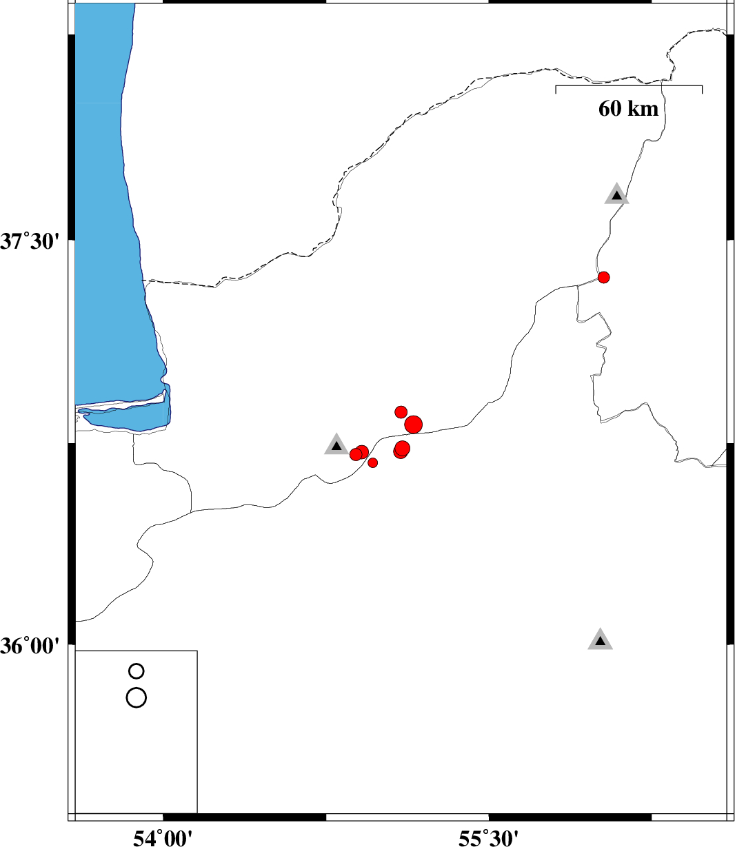
| 2015/09/05 | 05:27:49.4 | 09:57:49.4 | 36.864 | 55.095 | 14 | ML:2.5 | Golestan Province, 17 km South of Ramian | ||
| 2015/09/03 | 21:10:34.5 | 01:40:34.5 | 36.677 | 54.965 | 14 | ML:2 | Semnan Province, 29 km North of Shahrud | ||
| 2015/09/02 | 04:21:40.8 | 08:51:40.8 | 37.362 | 56.029 | 14 | ML:2.4 | Khorasan(north) Province, 47 km -East of Kalaleh | ||
| 2015/08/31 | 16:05:20.7 | 20:35:20.7 | 36.819 | 55.153 | 6 | ML:3.7 | Golestan Province, 22 km South of Ramian | ||
| 2015/08/29 | 21:58:12.5 | 02:28:12.5 | 36.708 | 54.888 | 14 | ML:2.6 | Golestan Province, 22 km South of Ali Abad | ||
| 2015/08/29 | 21:55:25.9 | 02:25:25.9 | 36.716 | 54.914 | 14 | ML:2.8 | Golestan Province, 21 km South of Ali Abad | ||
| 2015/08/29 | 08:52:51.7 | 13:22:51.7 | 36.73 | 55.101 | 15 | ML:3.1 | Semnan Province, 32 km South of Ramian | ||
| 2015/08/29 | 07:52:36.9 | 12:22:36.9 | 36.719 | 55.094 | 6 | ML:3 | Semnan Province, 33 km South of Ramian |