
Magnitude |
:2.4 |
| Date & Time (UTC) | 2015-09-02 04:21:40.8 |
| Date & Time (Local) | 1394/6/11 08:51:40.8 |
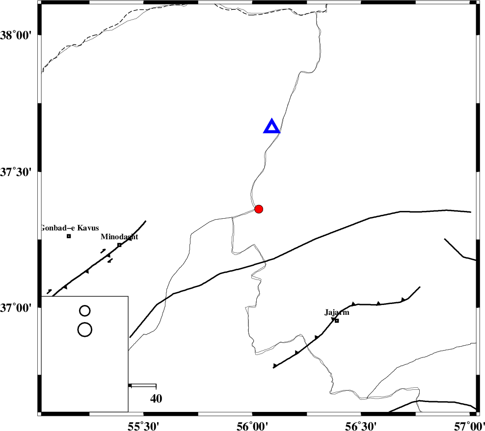
| Location | Lat:37.362 Lon: 56.029 |
| Region | Khorasan(north) Province, 47 km -East of Kalaleh |
Nearest Cities |
|
| 32 km South of Golidagh, Golestan Province | |
| 36 km East of Aq qamish, Golestan Province | |
| 40 km South East of Pashikmar, Golestan Province | |
| 40 km North East of Farsian, Golestan Province | |
| 40 km North East of Rezvan, Semnan Province | |
| Depth | 14 km |
| Agency | |
Faults within 150 km: |
|
| ROBATE_QARABIL_F (Length: 168 km) , Distance to epicenter: 21 km | |
| JAJARAM_F (Length: 77 km) , Distance to epicenter: 54 km | |
| ESFARAYEN_F (Length: 111 km) , Distance to epicenter: 76 km | |
| Number of Phases | 5 |
| RMS | 0.1 |
| Number of Stations | 3 |
| Error in Latitude | >1.1 km |
| Error in Longitude | 3.6 km |
| Error in Depth | 9.8 km |
Download waveform in seisan format
to download seisan software Click here
to access information about IIEES stations Click here
Amplitude | ||||||||
| UID | Agency | Station | Component | Amplitude | Period | Arrival Time | Proccessing Time | Signal Clip |
| 100668 | IIEES | MRVT | N | 395.2 | 0.12 | 2015-09-02 04:21:52 | 2015-09-02 06:20:00 | n |
| 100669 | IIEES | MRVT | E | 518.9 | 0.14 | 2015-09-02 04:21:52 | 2015-09-02 06:20:00 | n |
Phase | ||||||||||||
| Agency | Station | Component | Phase Type | Phase Quality | First Motion | Observed Arrival Time | Time Residual | Loc. Flag | Input Weight | Distance | Azimuth | |
| IIEES | MRVT | Z | Pg | E | 2015-09-02 04:21:47 | -0.1 | y | 33.4 | 9 | |||
| IIEES | MRVT | E | Sg | E | 2015-09-02 04:21:52 | 0.07 | y | 33.4 | 9 | |||
| IIEES | BJRD | Z | Pg | E | 2015-09-02 04:22:02 | 0 | y | 128 | 72 | |||
| IIEES | SHRO | Z | P | E | 2015-09-02 04:22:05 | 0.03 | y | 150 | 181 | |||
| IIEES | SHRO | E | Sg | E | 2015-09-02 04:22:24 | 0 | y | 150 | 181 | |||