
| Prel. Rep. | Date | Time(UTC) | Time(Local) | Lat. | Lon. | Depth | Mag. | Region | Waveform |
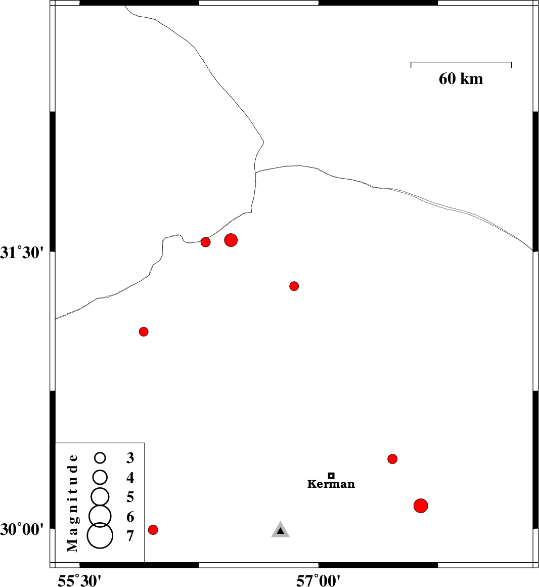
| 2015/08/24 | 18:44:45.2 | 23:14:45.2 | 31.314 | 56.846 | 15 | ML:2.6 | Kerman Province, 6 km of Ravar | ||
| 2015/08/23 | 11:59:11.9 | 16:29:11.9 | 31.551 | 56.291 | 14 | ML:2.7 | Kerman Province, 59 km North-West of Ravar | ||
| 2015/08/23 | 07:13:36.7 | 11:43:36.7 | 31.068 | 55.902 | 14 | ML:2.6 | Kerman Province, 74 km North of Rafsanjan | ||
| 2015/08/22 | 09:13:27.1 | 13:43:27.1 | 31.562 | 56.45 | 14 | ML:3.6 | Kerman Province, 48 km North-West of Ravar | ||
| 2015/08/21 | 01:21:17.3 | 05:51:17.3 | 30.124 | 57.641 | 14 | ML:4 | Kerman Province, 57 km South-East of Kerman | ||
| 2015/08/18 | 02:22:33.4 | 06:52:33.4 | 30.378 | 57.463 | 10 | ML:2.7 | Kerman Province, 38 km -East of Kerman | ||
| 2015/08/17 | 10:34:31.0 | 15:04:31.0 | 29.992 | 55.961 | 14 | ML:2.7 | Kerman Province, 46 km South of Rafsanjan |