
| Prel. Rep. | Date | Time(UTC) | Time(Local) | Lat. | Lon. | Depth | Mag. | Region | Waveform |
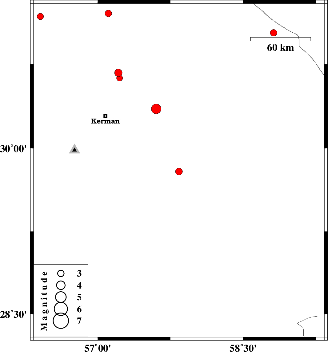
| 2025/09/22 | 07:56:58.3 | 11:26:58.3 | 29.79 | 57.838 | 12 | ML:3.3 | Kerman Province, 91 km North-West of Bam | ||
| 2025/09/15 | 09:07:24.1 | 12:37:24.1 | 30.673 | 57.212 | 12 | ML:3.5 | Kerman Province, 45 km North-East of Kerman | ||
| 2025/09/06 | 22:48:08.6 | 02:18:08.6 | 31.174 | 56.408 | 12 | ML:3 | Kerman Province, 40 km -West of Ravar | ||
| 2025/08/31 | 22:04:45.3 | 01:34:45.3 | 30.626 | 57.225 | 12 | ML:2.8 | Kerman Province, 40 km North-East of Kerman | ||
| 2025/08/31 | 19:56:44.1 | 23:26:44.1 | 30.352 | 57.603 | 12 | ML:4.5 | Kerman Province, 51 km -East of Kerman | ||
| 2025/08/30 | 16:55:15.2 | 20:25:15.2 | 31.03 | 58.814 | 12 | ML:3.1 | Kerman Province, 129 km South-West of Nehbandan | ||
| 2025/08/24 | 02:52:25.8 | 06:22:25.8 | 31.202 | 57.109 | 12 | ML:3.1 | Kerman Province, 29 km -East of Ravar |