
Magnitude |
:3.1 |
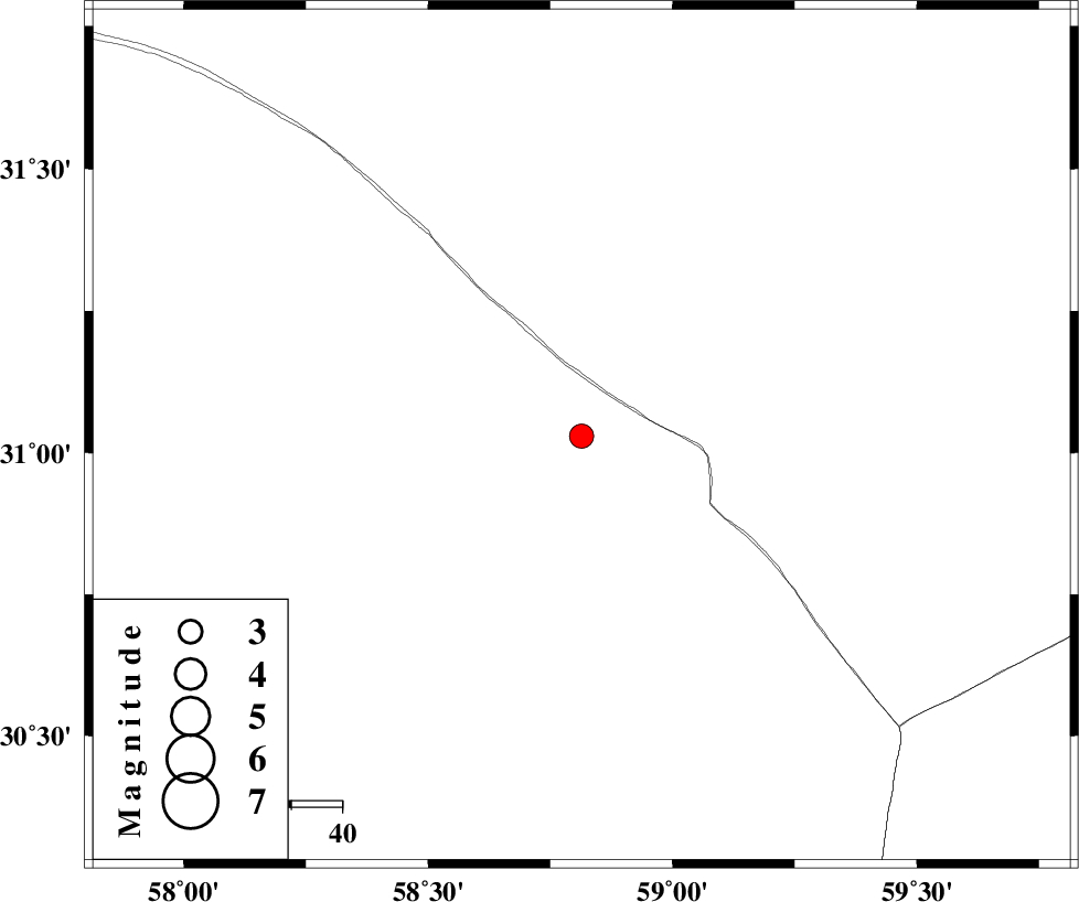
| Date & Time (UTC) | 2025-08-30 16:55:15.2 |
| Date & Time (Local) | 1404/6/8 20:25:15.2 |
| Location | Lat:31.03 Lon: 58.814 |
| Region | Kerman Province, 129 km South-West of Nehbandan |
Nearest Cities |
|
| 114 km North East of Estehkam, Kerman Province | |
| 126 km North East of Shahdad, Kerman Province | |
| 129 km South West of Nehbandan, Khorasan(south) Province | |
| 146 km North East of Geshit, Kerman Province | |
| 148 km South West of Shusef, Khorasan(south) Province | |
| Depth | 12 km |
| Agency | |
Faults within 150 km: |
|
| W_NEH_F (Length: 158 km) , Distance to epicenter: 114 km | |
| E_NEH_F (Length: 148 km) , Distance to epicenter: 117 km | |
| NAYBAND_F (Length: 258 km) , Distance to epicenter: 121 km | |
| Number of Phases | 6 |
| RMS | 0.8 |
| Number of Stations | 6 |
| Error in Latitude | >9.1 km |
| Error in Longitude | 9.1 km |
| Error in Depth | 999 km |
Download waveform in seisan format
to download seisan software Click here
to access information about IIEES stations Click here
Amplitude | ||||||||
| UID | Agency | Station | Component | Amplitude | Period | Arrival Time | Proccessing Time | Signal Clip |
| 198994 | IIEES SC | KRBR | Z | 0.3 | 1 | 2025-08-30 16:55:51 | 2025-09-02 07:21:00 | n |
| 198995 | IIEES SC | TABS | Z | 0.07 | 1 | 2025-08-30 16:56:05 | 2025-09-02 07:21:00 | n |
| 198996 | IIEES SC | YZKH | Z | 0.04 | 1 | 2025-08-30 16:56:17 | 2025-09-02 07:21:00 | n |
Phase | ||||||||||||
| Agency | Station | Component | Phase Type | Phase Quality | First Motion | Observed Arrival Time | Time Residual | Loc. Flag | Input Weight | Distance | Azimuth | |
| IIEES SC | BSRN | Z | EPg | E | 2025-08-30 16:55:18 | -15.2 | n | 4 | 108 | 16 | ||
| IIEES SC | KRBR | Z | EPn | E | 2025-08-30 16:55:51 | -0.6 | y | 0 | 229 | 240 | ||
| IIEES SC | SHRT | Z | EPn | E | 2025-08-30 16:56:02 | -0.9 | y | 0 | 322 | 26 | ||
| IIEES SC | TABS | Z | EPn | E | 2025-08-30 16:56:05 | 1 | y | 0 | 331 | 331 | ||
| IIEES SC | YZKH | Z | EPn | E | 2025-08-30 16:56:17 | 0.6 | y | 0 | 428 | 291 | ||
| IIEES SC | IRSR | Z | EPn | E | 2025-08-30 16:56:25 | 0.9 | y | 0 | 492 | 156 | ||