
| Prel. Rep. | Date | Time(UTC) | Time(Local) | Lat. | Lon. | Depth | Mag. | Region | Waveform |
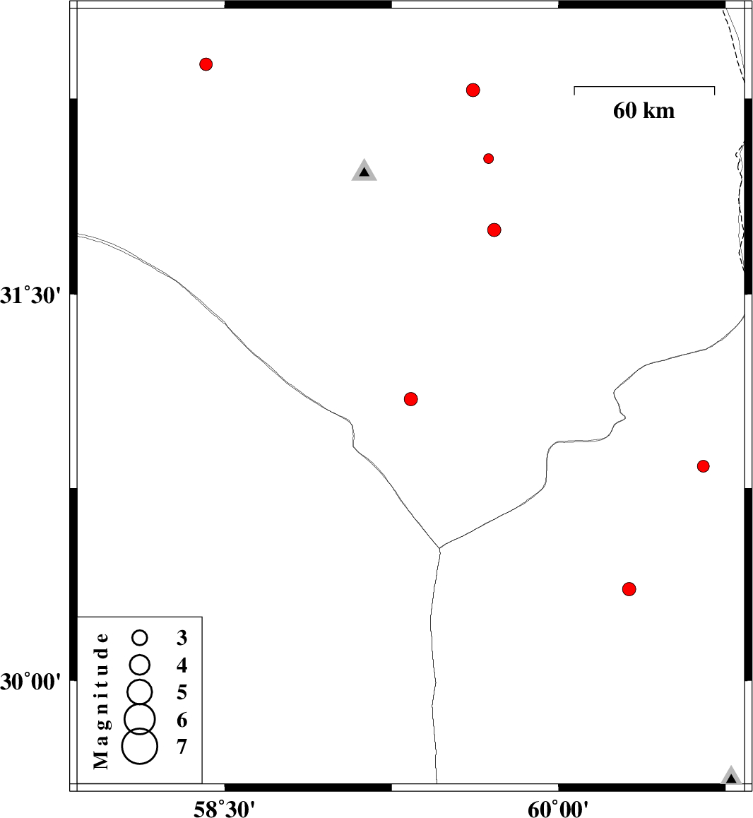
| 2015/10/15 | 02:48:03.7 | 06:18:03.7 | 31.096 | 59.336 | 14 | ML:2.7 | Khorasan(south) Province, 83 km South-West of Nehbandan | ||
| 2015/10/11 | 00:57:04.2 | 04:27:04.2 | 30.836 | 60.651 | 14 | ML:2.4 | Sistan va Baloochestan Province, 84 km South-West of Zabol | ||
| 2015/10/05 | 20:35:08.2 | 00:05:08.2 | 31.748 | 59.711 | 6 | ML:2.7 | Khorasan(south) Province, 39 km North-West of Nehbandan | ||
| 2015/10/01 | 22:07:23.6 | 01:37:23.6 | 32.283 | 59.616 | 6 | ML:2.7 | Khorasan(south) Province, 41 km South-West of Sarbisheh | ||
| 2015/09/29 | 02:14:27.7 | 05:44:27.7 | 32.021 | 59.685 | 14 | ML:2 | Khorasan(south) Province, 68 km South-West of Sarbisheh | ||
| 2015/09/28 | 06:32:51.8 | 10:02:51.8 | 32.381 | 58.416 | 17 | ML:2.6 | Khorasan(south) Province, 95 km South-West of Birjand | ||
| 2015/09/26 | 10:37:28.1 | 14:07:28.1 | 29.884 | 57.905 | 14 | ML:2.1 | Kerman Province, 97 km North-West of Bam | ||
| 2015/09/19 | 09:22:34.2 | 13:52:34.2 | 30.358 | 60.318 | 18 | ML:2.7 | Sistan va Baloochestan Province, 109 km North-West of Zahedan |