
Magnitude |
:2.7 |
| Date & Time (UTC) | 2015-10-05 20:35:08.2 |
| Date & Time (Local) | 1394/7/14 00:05:08.2 |
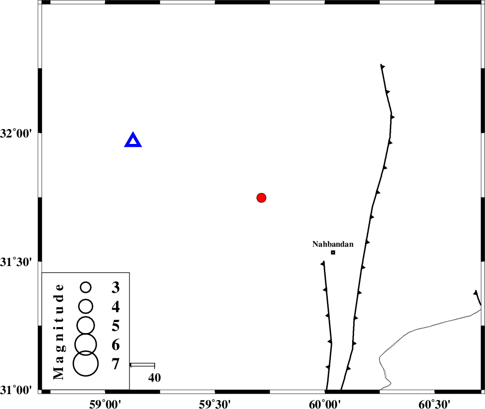
| Location | Lat:31.748 Lon: 59.711 |
| Region | Khorasan(south) Province, 39 km North-West of Nehbandan |
Nearest Cities |
|
| 32 km South West of Shusef, Khorasan(south) Province | |
| 39 km North West of Nehbandan, Khorasan(south) Province | |
| 86 km South East of Mokhtaran, Khorasan(south) Province | |
| 90 km South East of Kalateh soleyman, Khorasan(south) Province | |
| 92 km South of Salmabad, Khorasan(south) Province | |
| Depth | 6 km |
| Agency | |
Faults within 150 km: |
|
| W_NEH_F (Length: 158 km) , Distance to epicenter: 38 km | |
| E_NEH_F (Length: 148 km) , Distance to epicenter: 48 km | |
| SEFIDABAD_F (Length: 26 km) , Distance to epicenter: 101 km | |
| Number of Phases | 5 |
| RMS | 0 |
| Number of Stations | 4 |
| Error in Latitude | >4.5 km |
| Error in Longitude | 5.1 km |
| Error in Depth | 4.2 km |
Download waveform in seisan format
to download seisan software Click here
to access information about IIEES stations Click here
Amplitude | ||||||||
| UID | Agency | Station | Component | Amplitude | Period | Arrival Time | Proccessing Time | Signal Clip |
| 101466 | IIEES | YZKH | N | 6.7 | 0.69 | 2015-10-05 20:37:35 | 2015-10-06 05:08:00 | n |
| 101467 | IIEES | YZKH | E | 7.2 | 0.53 | 2015-10-05 20:37:40 | 2015-10-06 05:08:00 | n |
Phase | ||||||||||||
| Agency | Station | Component | Phase Type | Phase Quality | First Motion | Observed Arrival Time | Time Residual | Loc. Flag | Input Weight | Distance | Azimuth | |
| IIEES | BSRN | Z | Pg | E | 2015-10-05 20:35:18 | -0.01 | y | 60.4 | 294 | |||
| IIEES | BSRN | N | Sg | E | 2015-10-05 20:35:26 | 0.01 | y | 60.4 | 294 | |||
| IIEES | ZHSF | Z | Pn | E | 2015-10-05 20:35:48 | 0.01 | y | 258 | 156 | |||
| IIEES | TABS | Z | Pn | E | 2015-10-05 20:35:56 | 0.01 | y | 322 | 312 | |||
| IIEES | YZKH | Z | Pn | E | 2015-10-05 20:36:17 | -0.02 | y | 489 | 280 | |||