
Magnitude |
:2 |
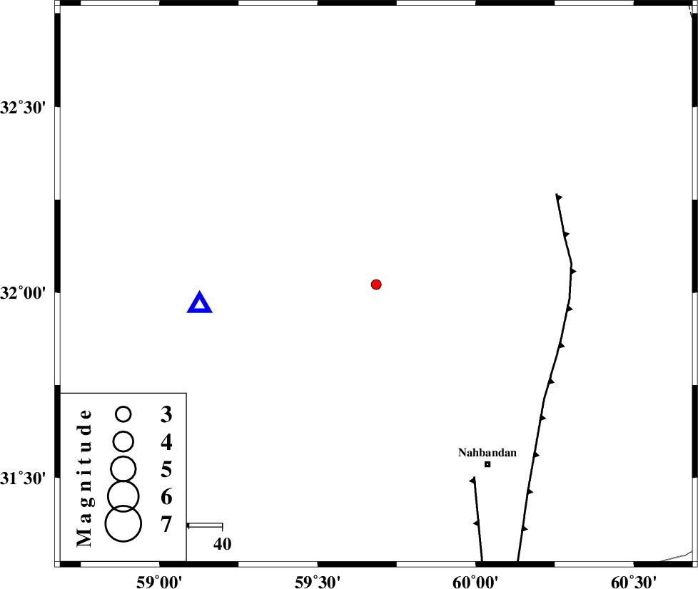
| Date & Time (UTC) | 2015-09-29 02:14:27.7 |
| Date & Time (Local) | 1394/7/7 05:44:27.7 |
| Location | Lat:32.021 Lon: 59.685 |
| Region | Khorasan(south) Province, 68 km South-West of Sarbisheh |
Nearest Cities |
|
| 23 km North West of Shusef, Khorasan(south) Province | |
| 57 km South East of Mokhtaran, Khorasan(south) Province | |
| 60 km South East of Kalateh soleyman, Khorasan(south) Province | |
| 62 km South West of Salmabad, Khorasan(south) Province | |
| 63 km North West of Nehbandan, Khorasan(south) Province | |
| Depth | 14 km |
| Agency | |
Faults within 150 km: |
|
| E_NEH_F (Length: 148 km) , Distance to epicenter: 58 km | |
| W_NEH_F (Length: 158 km) , Distance to epicenter: 65 km | |
| NOZAD_F (Length: 27 km) , Distance to epicenter: 104 km | |
| Number of Phases | 6 |
| RMS | 0.1 |
| Number of Stations | 4 |
| Error in Latitude | >2.1 km |
| Error in Longitude | 5.3 km |
| Error in Depth | 5.3 km |
Download waveform in seisan format
to download seisan software Click here
to access information about IIEES stations Click here
Amplitude | ||||||||
| UID | Agency | Station | Component | Amplitude | Period | Arrival Time | Proccessing Time | Signal Clip |
| 101214 | IIEES | BSRN | E | 84.1 | 0.18 | 2015-09-29 02:14:45 | 2015-09-29 07:10:00 | n |
| 101215 | IIEES | TABS | E | 8.5 | 0.37 | 2015-09-29 02:16:07 | 2015-09-29 07:10:00 | n |
Phase | ||||||||||||
| Agency | Station | Component | Phase Type | Phase Quality | First Motion | Observed Arrival Time | Time Residual | Loc. Flag | Input Weight | Distance | Azimuth | |
| IIEES | BSRN | Z | Pg | E | 2015-09-29 02:14:37 | -0.06 | y | 53.2 | 263 | |||
| IIEES | TABS | Z | Pn | E | 2015-09-29 02:15:12 | -0.05 | y | 301 | 308 | |||
| IIEES | TABS | N | Sg | E | 2015-09-29 02:15:52 | 0.07 | y | 301 | 308 | |||
| IIEES | KRBR | Z | Pn | E | 2015-09-29 02:15:20 | 0.11 | y | 359 | 232 | |||
| IIEES | YZKH | Z | Pn | E | 2015-09-29 02:15:35 | -0.05 | y | 482 | 276 | |||
| IIEES | YZKH | N | Sg | E | 2015-09-29 02:16:42 | -0.02 | y | 482 | 276 | |||