| Prel. Rep. | Date | Time(UTC) | Time(Local) | Lat. | Lon. | Depth | Mag. | Region | Waveform |
|
|
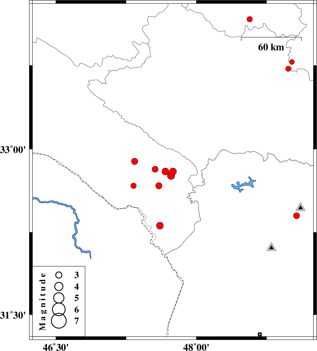
2015/03/19
|
21:29:53.9
|
00:59:53.9
| 32.8 | 47.75 | 18 |
ML:3.4
|
Ilam Province, 40 km South of Pol-e dokhtar | |
|
|
2015/03/19
|
07:34:05.2
|
11:04:05.2
| 32.76 | 47.73 | 14 |
ML:3.5
|
Ilam Province, 43 km South of Pol-e dokhtar | |
|
|
2015/03/17
|
15:46:10.5
|
19:16:10.5
| 32.8 | 47.67 | 14 |
ML:3.4
|
Ilam Province, 24 km South-East of Abdanan | |
|
|
2015/03/12
|
15:49:03.8
|
19:19:03.8
| 32.67 | 47.33 | 35 |
ML:2.7
|
Ilam Province, 7 km Dehloran | |
|
|
2015/03/08
|
03:40:22.8
|
07:10:22.8
| 32.4 | 49.07 | 34 |
ML:3
|
Khoozestan Province, 4 km Lali | |
|
|
2015/03/07
|
22:02:12.2
|
01:32:12.2
| 32.89 | 47.34 | 18 |
ML:3.1
|
Ilam Province, 13 km West of Abdanan | |
|
|
2015/03/03
|
17:58:13.1
|
21:28:13.1
| 32.67 | 47.6 | 14 |
ML:3.1
|
Ilam Province, 32 km East of Dehloran | |
|
|
2015/03/02
|
21:40:29.4
|
01:10:29.4
| 33.72 | 48.98 | 28 |
ML:2.5
|
Lorestan Province, 28 km North of Dorud | |
|
|
2015/03/02
|
18:02:27.1
|
21:32:27.1
| 33.78 | 49.02 | 18 |
ML:2.4
|
Markazi Province, 33 km North of Dorud | |
|
|
2015/03/01
|
02:43:54.5
|
06:13:54.5
| 32.82 | 47.56 | 14 |
ML:3
|
Ilam Province, 14 km South of Abdanan | |
|
|
2015/02/23
|
14:13:12.0
|
17:43:12.0
| 34.16 | 48.57 | 14 |
ML:2.7
|
Hamedan Province, 20 km East of Nahavand | |
|
|
2015/02/18
|
17:55:00.3
|
21:25:00.3
| 32.31 | 47.61 | 18 |
ML:3.4
|
Ilam Province, 54 km South-East of Dehloran | |
