
| Prel. Rep. | Date | Time(UTC) | Time(Local) | Lat. | Lon. | Depth | Mag. | Region | Waveform |
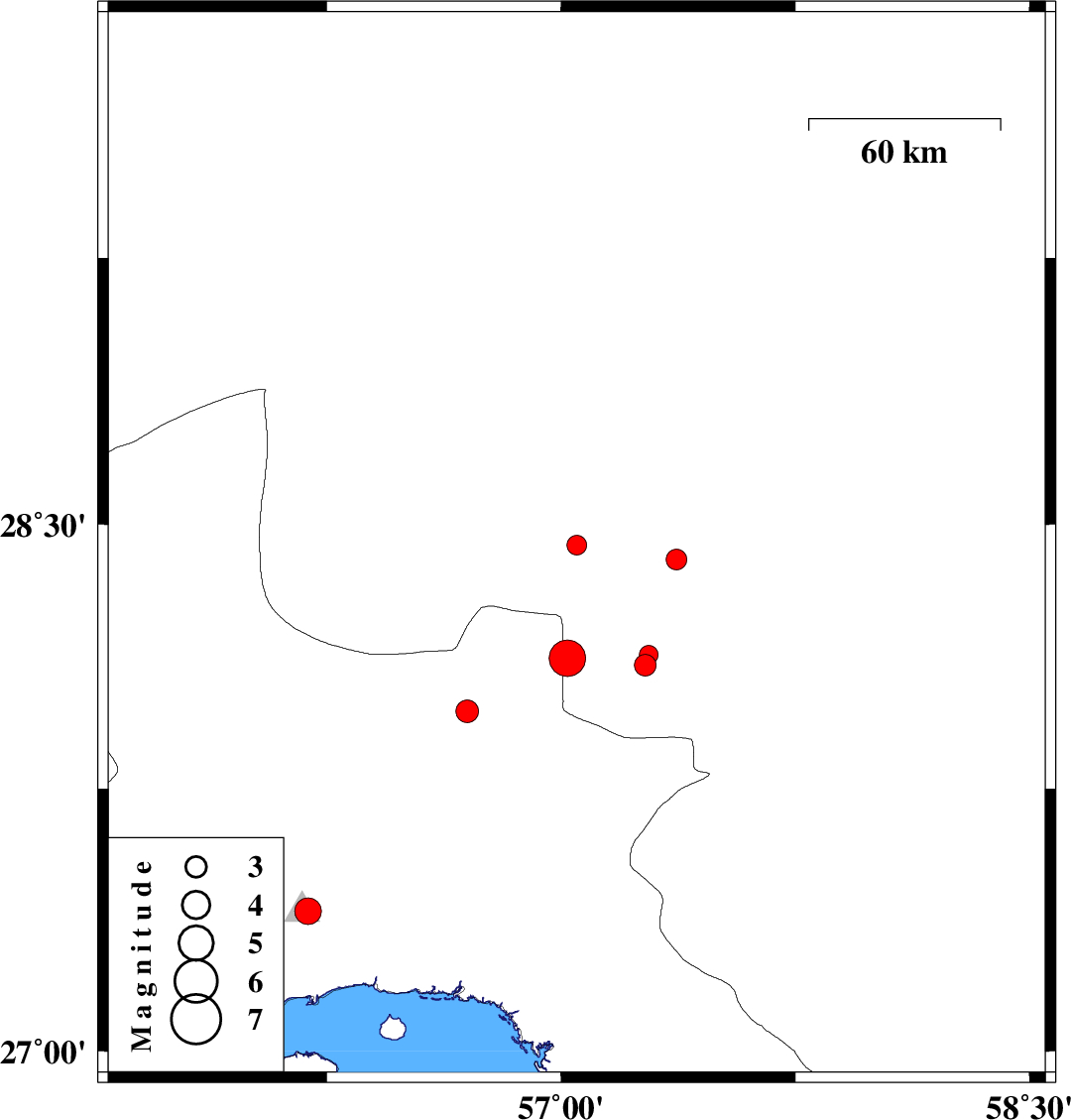
| 2015/03/05 | 22:54:50.2 | 02:24:50.2 | 28.12 | 57.02 | 18 | ML:5.2 | Kerman Province, 68 km North-West of Kahnuj | ||
| 2015/03/05 | 22:35:44.1 | 02:05:44.1 | 28.44 | 57.05 | 14 | ML:2.8 | Kerman Province, 72 km South-West of Jiroft | ||
| 2015/03/05 | 19:31:11.7 | 23:01:11.7 | 27.4 | 56.19 | 14 | ML:3.8 | Hormozgan Province, 26 km North of Bandar-e abbas | ||
| 2015/03/05 | 11:25:20.7 | 14:55:20.7 | 28.1 | 57.27 | 14 | ML:3.1 | Kerman Province, 45 km North-West of Kahnuj | ||
| 2015/03/05 | 11:23:06.1 | 14:53:06.1 | 28.13 | 57.28 | 34 | ML:2.7 | Kerman Province, 45 km North-West of Kahnuj | ||
| 2015/03/04 | 16:08:48.0 | 19:38:48.0 | 27.97 | 56.7 | 14 | ML:3.2 | Hormozgan Province, 98 km West of Kahnuj | ||
| 2015/02/28 | 01:18:55.3 | 04:48:55.3 | 28.4 | 57.37 | 14 | ML:2.9 | Kerman Province, 47 km South-West of Jiroft |