
Magnitude |
:5.2 |
| Date & Time (UTC) | 2015-03-05 22:54:50.2 |
| Date & Time (Local) | 1393/12/15 02:24:50.2 |
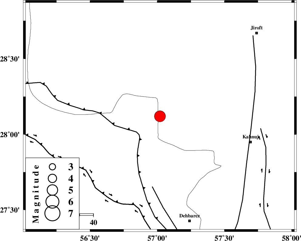
| Location | Lat:28.12 Lon: 57.02 |
| Region | Kerman Province, 68 km North-West of Kahnuj |
Nearest Cities |
|
| 25 km North West of Faryab, Kerman Province | |
| 28 km South East of Sarkhan, Kerman Province | |
| 30 km West of Hurpasefid, Kerman Province | |
| 38 km North West of Mehrueye-e paeen, Kerman Province | |
| 42 km North West of Fariab, Hormozgan Province | |
| Depth | 18 km |
| Agency | |
Faults within 150 km: |
|
| MAIN_ZAGROS_R_F (Length: 1106 km) , Distance to epicenter: 20 km | |
| ZENDAN_MINAB_F_Z1 (Length: 183 km) , Distance to epicenter: 52 km | |
| SABZEVARAN_F (Length: 190 km) , Distance to epicenter: 67 km | |
| Number of Phases | 6 |
| RMS | 0 |
| Number of Stations | 5 |
| Error in Latitude | >2.3 km |
| Error in Longitude | 3.5 km |
| Error in Depth | 8.8 km |
Download waveform in seisan format
to download seisan software Click here
to access information about IIEES stations Click here
Amplitude | ||||||||
| UID | Agency | Station | Component | Amplitude | Period | Arrival Time | Proccessing Time | Signal Clip |
| 95175 | IIEES | BNDS | E | 58109.2 | 0.4 | 2015-03-05 22:55:26 | 2015-03-05 11:31:00 | n |
Phase | ||||||||||||
| Agency | Station | Component | Phase Type | Phase Quality | First Motion | Observed Arrival Time | Time Residual | Loc. Flag | Input Weight | Distance | Azimuth | |
| IIEES | BNDS | Z | Pg | E | 2015-03-05 22:55:09 | -0.03 | y | 116 | 227 | |||
| IIEES | BNDS | E | Sg | E | 2015-03-05 22:55:23 | 0.03 | y | 116 | 227 | |||
| IIEES | KRBR | Z | Pn | E | 2015-03-05 22:55:23 | -0.02 | y | 209 | 353 | |||
| IIEES | CHBR | Z | Pn | E | 2015-03-05 22:55:52 | -0.02 | y | 443 | 128 | |||
| IIEES | BSRN | Z | Pn | E | 2015-03-05 22:55:56 | 0.07 | y | 473 | 25 | |||
| IIEES | YZKH | Z | Pn | E | 2015-03-05 22:56:03 | -0.03 | y | 529 | 334 | |||