| Prel. Rep. | Date | Time(UTC) | Time(Local) | Lat. | Lon. | Depth | Mag. | Region | Waveform |
|
|
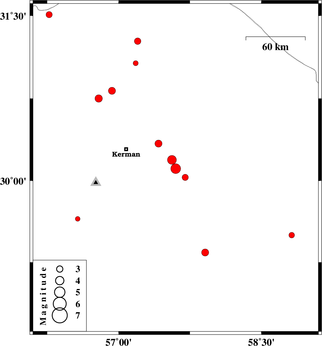
2015/02/17
|
13:41:37.4
|
17:11:37.4
| 30.11 | 57.6 | 14 |
ML:4.6
|
Kerman Province, 53 km South-East of Kerman | |
|
|
2015/02/17
|
07:42:15.9
|
11:12:15.9
| 30.75 | 56.79 | 15 |
ML:3.5
|
Kerman Province, 22 km East of Zarand | |
|
|
2015/02/13
|
01:00:45.2
|
04:30:45.2
| 30.19 | 57.56 | 14 |
ML:4.3
|
Kerman Province, 48 km East of Kerman | |
|
|
2015/02/11
|
16:48:33.9
|
20:18:33.9
| 30.82 | 56.93 | 15 |
ML:3.4
|
Kerman Province, 34 km East of Zarand | |
|
|
2015/02/07
|
00:42:21.5
|
04:12:21.5
| 29.65 | 56.57 | 14 |
ML:2.3
|
Kerman Province, 31 km South of Bardsir | |
|
|
2015/02/05
|
15:02:30.9
|
18:32:30.9
| 29.5 | 58.82 | 14 |
ML:2.7
|
Kerman Province, 63 km North-East of Bam | |
|
|
2015/02/04
|
02:18:35.7
|
05:48:35.7
| 30.03 | 57.7 | 16 |
ML:3
|
Kerman Province, 66 km South-East of Kerman | |
|
|
2015/02/02
|
04:28:35.7
|
07:58:35.7
| 31.27 | 57.2 | 14 |
ML:3.1
|
Kerman Province, 36 km East of Ravar | |
|
|
2015/01/31
|
02:53:14.7
|
06:23:14.7
| 31.07 | 57.18 | 14 |
ML:2.4
|
Kerman Province, 41 km South-East of Ravar | |
|
|
2015/01/28
|
15:12:49.1
|
18:42:49.1
| 31.51 | 56.27 | 17 |
ML:3
|
Kerman Province, 58 km North-West of Ravar | |
|
|
2015/01/28
|
10:38:35.5
|
14:08:35.5
| 29.34 | 57.91 | 14 |
ML:3.4
|
Kerman Province, 51 km North-West of Bam | |
|
|
2015/01/18
|
09:09:28.5
|
12:39:28.5
| 30.34 | 57.42 | 14 |
ML:3.4
|
Kerman Province, 33 km East of Kerman | |
