
Magnitude |
:3.4 |
| Date & Time (UTC) | 2015-02-11 16:48:33.9 |
| Date & Time (Local) | 1393/11/22 20:18:33.9 |
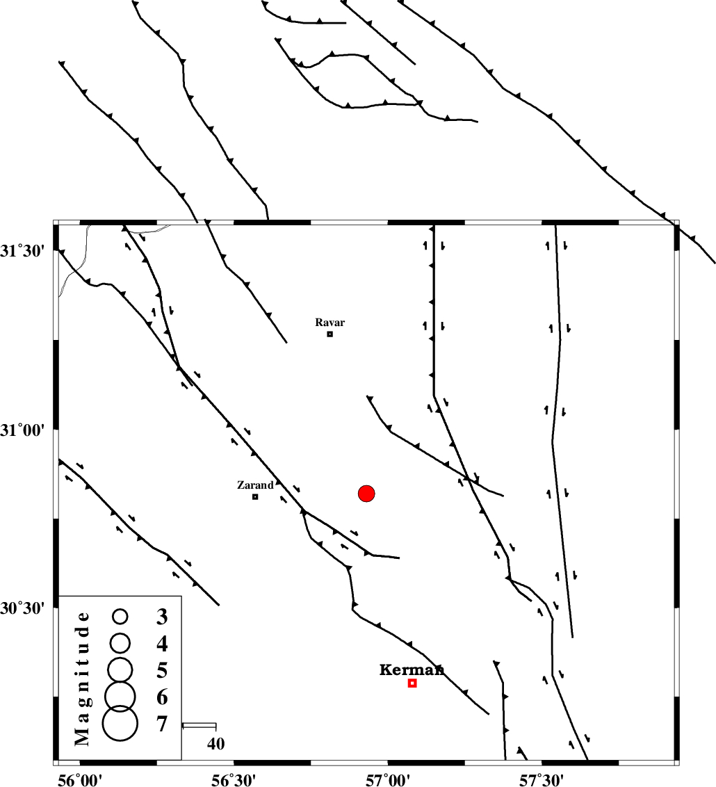
| Location | Lat:30.82 Lon: 56.93 |
| Region | Kerman Province, 34 km East of Zarand |
Nearest Cities |
|
| 8 km North of Hejdak, Kerman Province | |
| 14 km East of Hatkan, Kerman Province | |
| 18 km North East of Khankuk, Kerman Province | |
| 24 km North of Chatrud, Kerman Province | |
| 27 km North West of Harjand, Kerman Province | |
| Depth | 15 km |
| Agency | |
Faults within 150 km: |
|
| KUHBANAN_F (Length: 189 km) , Distance to epicenter: 15 km | |
| CHATRUD_F (Length: 37 km) , Distance to epicenter: 25 km | |
| LAKARKUH_F (Length: 138 km) , Distance to epicenter: 33 km | |
| Number of Phases | 6 |
| RMS | 0 |
| Number of Stations | 4 |
| Error in Latitude | >1.3 km |
| Error in Longitude | 2.4 km |
| Error in Depth | 4.6 km |
Download waveform in seisan format
to download seisan software Click here
to access information about IIEES stations Click here
Amplitude | ||||||||
| UID | Agency | Station | Component | Amplitude | Period | Arrival Time | Proccessing Time | Signal Clip |
| 95022 | IIEES | TABS | N | 128.4 | 0.48 | 2015-02-11 16:50:19 | 2015-02-11 05:14:00 | n |
Phase | ||||||||||||
| Agency | Station | Component | Phase Type | Phase Quality | First Motion | Observed Arrival Time | Time Residual | Loc. Flag | Input Weight | Distance | Azimuth | |
| IIEES | KRBR | Z | Pg | E | 2015-02-11 16:48:50 | 0.02 | y | 94 | 190 | |||
| IIEES | KRBR | E | Sg | E | 2015-02-11 16:49:01 | -0.01 | y | 94 | 190 | |||
| IIEES | BSRN | Z | Pn | E | 2015-02-11 16:49:12 | -0.04 | y | 245 | 58 | |||
| IIEES | YZKH | Z | Pn | E | 2015-02-11 16:49:16 | -0.01 | y | 282 | 309 | |||
| IIEES | YZKH | N | Sg | E | 2015-02-11 16:49:53 | -0.01 | y | 282 | 309 | |||
| IIEES | TABS | Z | Pn | E | 2015-02-11 16:49:20 | 0.05 | y | 314 | 3 | |||