
| Prel. Rep. | Date | Time(UTC) | Time(Local) | Lat. | Lon. | Depth | Mag. | Region | Waveform |
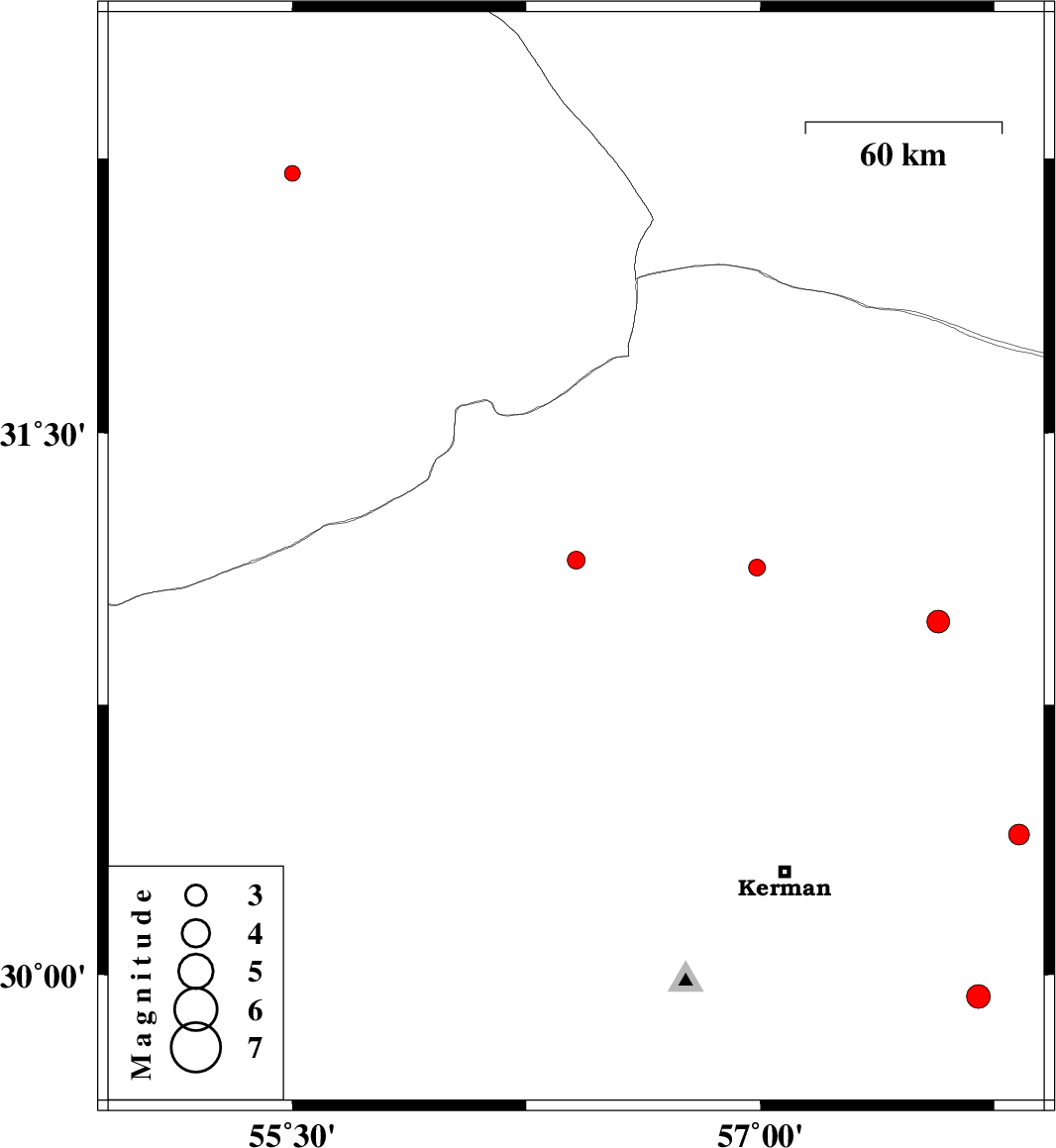
| 2014/06/25 | 04:33:22.8 | 09:03:22.8 | 31.15 | 56.41 | 15 | ML:2.6 | Kerman Province, 41 km North-West of Zarand | ||
| 2014/06/14 | 22:01:05.2 | 02:31:05.2 | 31.13 | 56.99 | 14 | ML:2.4 | Kerman Province, 22 km South-East of Ravar | ||
| 2014/06/14 | 12:53:46.3 | 17:23:46.3 | 32.21 | 55.5 | 15 | ML:2.3 | Yazd Province, 68 km North-East of Bafq | ||
| 2014/06/03 | 09:50:34.3 | 14:20:34.3 | 29.94 | 57.7 | 14 | ML:3.4 | Kerman Province, 71 km South-East of Kerman | ||
| 2014/05/30 | 16:49:56.3 | 21:19:56.3 | 30.98 | 57.57 | 18 | ML:3.2 | Kerman Province, 78 km South-East of Ravar | ||
| 2014/05/28 | 21:15:34.5 | 01:45:34.5 | 30.39 | 57.83 | 18 | ML:2.9 | Kerman Province, 73 km North-East of Kerman |