
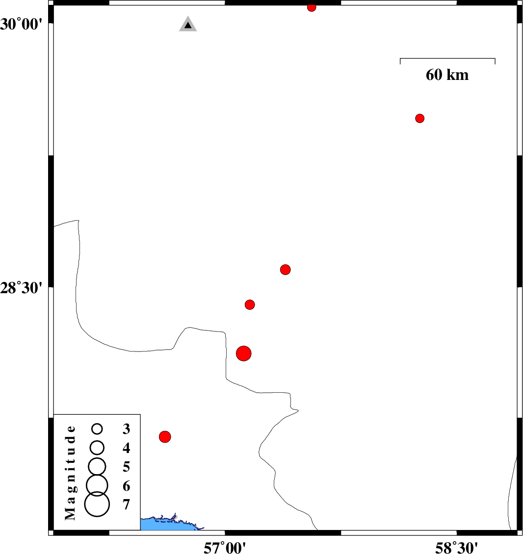
| Prel. Rep. | Date | Time(UTC) | Time(Local) | Lat. | Lon. | Depth | Mag. | Region | Waveform |
| 2014/02/20 | 10:06:46.1 | 13:36:46.1 | 28.6 | 57.39 | 18 | ML:3 | Kerman Province, 35 km West of Jiroft | ||
| 2014/02/06 | 11:28:54.5 | 14:58:54.5 | 28.4 | 57.16 | 14 | ML:2.8 | Kerman Province, 64 km South-West of Jiroft | ||
| 2014/02/02 | 18:15:42.9 | 21:45:42.9 | 28.12 | 57.12 | 14 | ML:4.4 | Kerman Province, 60 km North-West of Kahnuj | ||
| 2014/01/31 | 23:57:53.7 | 03:27:53.7 | 30.09 | 57.56 | 14 | ML:2.5 | Kerman Province, 51 km South-East of Kerman | ||
| 2014/01/27 | 13:40:54.8 | 17:10:54.8 | 27.64 | 56.61 | 18 | ML:3.4 | Hormozgan Province, 60 km North-East of Bandar-e abbas | ||
| 2014/01/24 | 17:11:36.5 | 20:41:36.5 | 29.46 | 58.26 | 37 | ML:2.5 | Kerman Province, 40 km North of Bam |