
| Prel. Rep. | Date | Time(UTC) | Time(Local) | Lat. | Lon. | Depth | Mag. | Region | Waveform |
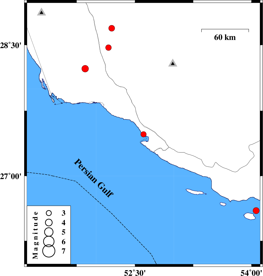
| 2013/01/22 | 12:25:52.7 | 15:55:52.7 | 27.48 | 52.61 | 14 | ML:3.3 | Bushehr Province, 29 km West of Mehr | ||
| 2013/01/06 | 00:10:50.6 | 03:40:50.6 | 28.47 | 52.16 | 14 | ML:3.4 | Fars Province, 45 km South of Farashband | ||
| 2013/01/05 | 17:55:18.7 | 21:25:18.7 | 28.69 | 52.2 | 14 | ML:3.5 | Fars Province, 23 km South-East of Farashband | ||
| 2013/01/05 | 12:50:01.2 | 16:20:01.2 | 28.23 | 51.86 | 18 | ML:4 | Bushehr Province, 49 km North-West of Bandar-e kangan | ||
| 2012/12/26 | 03:52:54.0 | 07:22:54.0 | 26.6 | 54.06 | 15 | ML:3.7 | Persian Gulf, 78 km West of Bandar-e lengeh |