
| Prel. Rep. | Date | Time(UTC) | Time(Local) | Lat. | Lon. | Depth | Mag. | Region | Waveform |
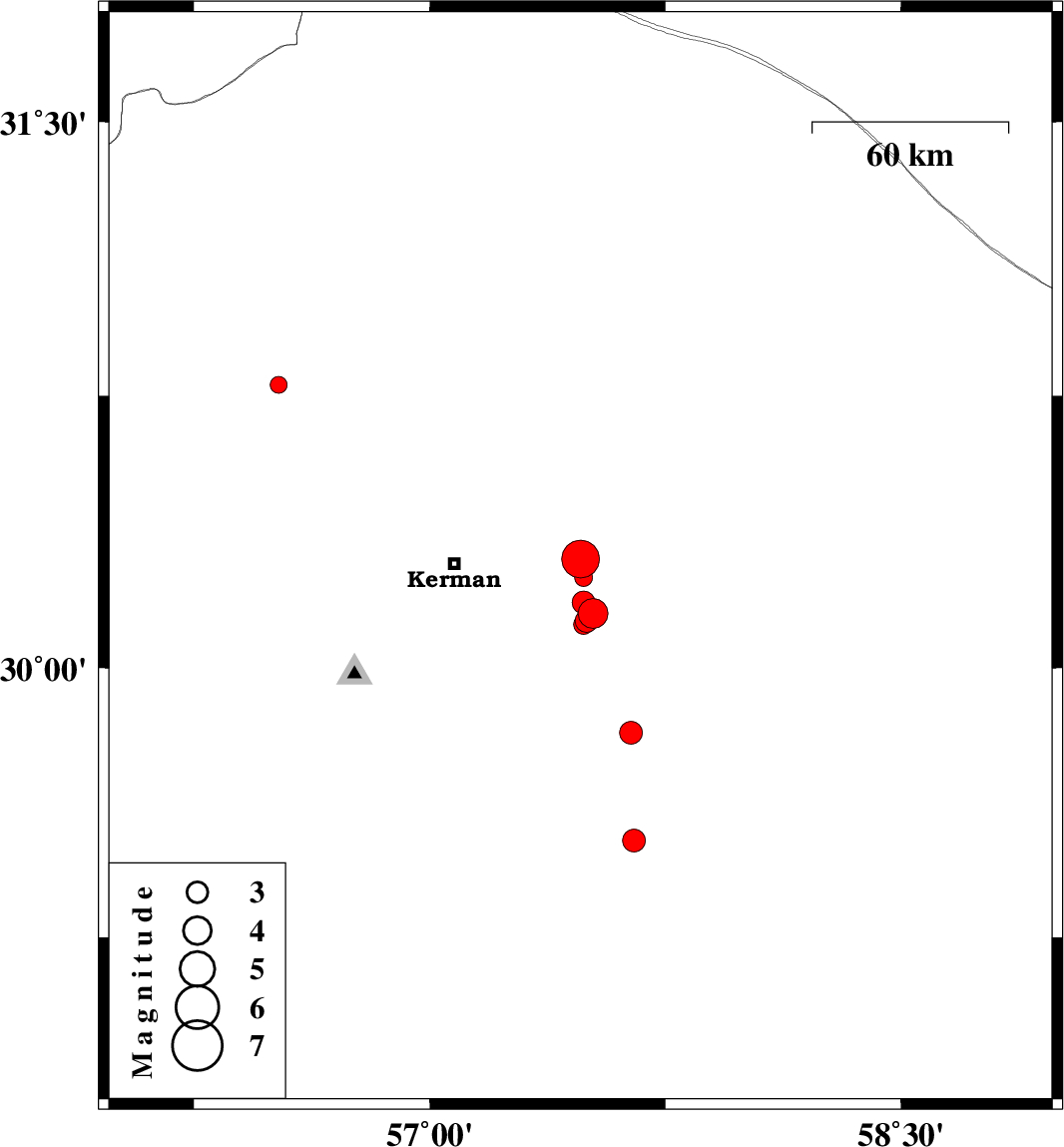
| 2013/01/21 | 19:48:58.5 | 23:18:58.5 | 30.3 | 57.48 | 28 | ML:5.3 | Kerman Province, 39 km East of Kerman | ||
| 2013/01/15 | 05:03:39.5 | 08:33:39.5 | 30.78 | 56.52 | 14 | ML:2.4 | Kerman Province, 6 km Zarand | ||
| 2013/01/14 | 05:07:27.0 | 08:37:27.0 | 29.52 | 57.65 | 14 | ML:3.2 | Kerman Province, 95 km North of Jiroft | ||
| 2013/01/07 | 18:16:51.9 | 21:46:51.9 | 29.82 | 57.64 | 18 | ML:3.3 | Kerman Province, 75 km South-East of Kerman | ||
| 2013/01/06 | 15:24:14.8 | 18:54:14.8 | 30.15 | 57.52 | 16 | ML:4.3 | Kerman Province, 45 km South-East of Kerman | ||
| 2013/01/06 | 15:13:17.3 | 18:43:17.3 | 30.18 | 57.49 | 17 | ML:3.2 | Kerman Province, 41 km South-East of Kerman | ||
| 2013/01/02 | 15:54:43.1 | 19:24:43.1 | 30.13 | 57.5 | 14 | ML:3.3 | Kerman Province, 44 km South-East of Kerman | ||
| 2012/12/31 | 19:13:10.3 | 22:43:10.3 | 30.12 | 57.49 | 14 | ML:2.8 | Kerman Province, 44 km South-East of Kerman | ||
| 2012/12/24 | 15:05:10.1 | 18:35:10.1 | 30.25 | 57.49 | 14 | ML:2.5 | Kerman Province, 40 km East of Kerman |