
Magnitude |
:5.3 |
| Date & Time (UTC) | 2013-01-21 19:48:58.5 |
| Date & Time (Local) | 1391/11/2 23:18:58.5 |
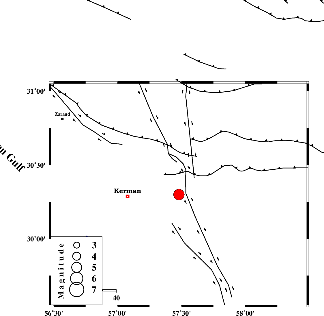
| Location | Lat:30.3 Lon: 57.48 |
| Region | Kerman Province, 39 km East of Kerman |
Nearest Cities |
|
| 14 km North of Sirch, Kerman Province | |
| 25 km South West of Shahdad, Kerman Province | |
| 25 km North West of Jushan, Kerman Province | |
| 30 km South East of Dehlulu, Kerman Province | |
| 32 km North East of Sarasiyab-e ferangi, Kerman Province | |
| Depth | 28 km |
| Agency | |
Faults within 150 km: |
|
| GOLBAF_SIRCH_F (Length: 114 km) , Distance to epicenter: 5 km | |
| SHAHDAD_F (Length: 108 km) , Distance to epicenter: 17 km | |
| NAYBAND_F (Length: 258 km) , Distance to epicenter: 17 km | |
| Number of Phases | 9 |
| RMS | 0.3 |
| Number of Stations | 9 |
| Error in Latitude | >4.2 km |
| Error in Longitude | 6 km |
| Error in Depth | 8.9 km |
Download waveform in seisan format
to download seisan software Click here
to access information about IIEES stations Click here
Amplitude | ||||||||
| UID | Agency | Station | Component | Amplitude | Period | Arrival Time | Proccessing Time | Signal Clip |
| 87664 | IIEES | TABS | E | 6433.8 | 0.92 | 2013-01-21 19:50:47 | 2013-01-22 09:21:00 | n |
Phase | ||||||||||||
| Agency | Station | Component | Phase Type | Phase Quality | First Motion | Observed Arrival Time | Time Residual | Loc. Flag | Input Weight | Distance | Azimuth | |
| IIEES | KRBR | Z | Pg | E | 2013-01-21 19:49:12 | 0 | y | 77.8 | 243 | |||
| IIEES | YZKH | Z | Pn | E | 2013-01-21 19:49:49 | -0.18 | y | 360 | 311 | |||
| IIEES | TABS | Z | Pn | E | 2013-01-21 19:49:51 | -0.36 | y | 373 | 355 | |||
| IIEES | SHRT | Z | Pn | E | 2013-01-21 19:50:02 | 0.63 | y | 456 | 35 | |||
| IIEES | GHIR | Z | Pn | E | 2013-01-21 19:50:06 | 0.47 | y | 490 | 244 | |||
| IIEES | CHBR | Z | Pn | E | 2013-01-21 19:50:18 | -0.47 | y | 599 | 150 | |||
| IIEES | SHRO | Z | Pn | E | 2013-01-21 19:50:25 | -0.06 | y | 648 | 348 | |||
| IIEES | MRVT | Z | Pn | E | 2013-01-21 19:50:47 | -0.05 | y | 827 | 351 | |||
| IIEES | CHTH | Z | Pn | E | 2013-01-21 19:50:51 | -0.03 | y | 859 | 318 | |||