
| Prel. Rep. | Date | Time(UTC) | Time(Local) | Lat. | Lon. | Depth | Mag. | Region | Waveform |
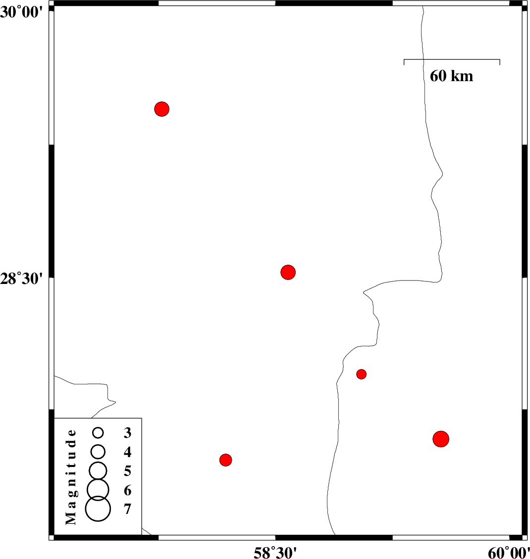
| 2012/10/29 | 10:51:00.2 | 14:21:00.2 | 28.53 | 58.58 | 14 | ML:4.3 | Kerman Province, 68 km South-East of Bam | ||
| 2012/10/21 | 16:38:24.1 | 20:08:24.1 | 27.58 | 59.56 | 15 | ML:4.7 | Sistan va Baloochestan Province, 119 km North-West of Iranshahr | ||
| 2012/10/16 | 23:43:53.5 | 03:13:53.5 | 27.46 | 58.18 | 14 | ML:3.5 | Kerman Province, 67 km East of Manujan | ||
| 2012/10/16 | 04:23:41.3 | 07:53:41.3 | 29.45 | 57.77 | 15 | ML:4.2 | Kerman Province, 87 km North of Jiroft | ||
| 2012/10/07 | 20:20:09.6 | 23:50:09.6 | 27.95 | 59.05 | 14 | ML:2.8 | Sistan va Baloochestan Province, 133 km East of Kahnuj |