| Prel. Rep. | Date | Time(UTC) | Time(Local) | Lat. | Lon. | Depth | Mag. | Region | Waveform |
|
|
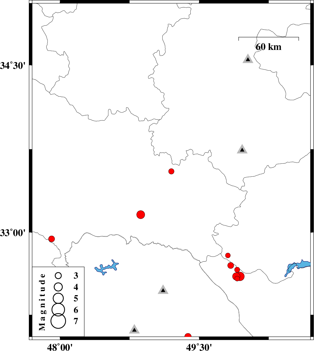
2012/07/24
|
16:22:39.5
|
20:52:39.5
| 32.94 | 47.91 | 14 |
ML:3
|
Lorestan Province, 30 km South-East of Pol-e dokhtar | |
|
|
2012/07/24
|
07:25:34.2
|
11:55:34.2
| 33.55 | 49.2 | 6 |
ML:2.7
|
Lorestan Province, 14 km East of Dorud | |
|
|
2012/07/23
|
12:53:02.2
|
17:23:02.2
| 32.79 | 49.81 | 7 |
ML:2.4
|
Esfahan Province, 33 km South-West of Fereydunshahr | |
|
|
2012/07/23
|
10:43:34.3
|
15:13:34.3
| 32.7 | 49.84 | 18 |
ML:2.9
|
Chaharmahal Bakhtiari Province, 36 km South-West of Fereydunshahr | |
|
|
2012/07/23
|
08:31:41.6
|
13:01:41.6
| 33.16 | 48.87 | 14 |
ML:4
|
Lorestan Province, 41 km South-West of Dorud | |
|
|
2012/07/22
|
16:23:27.1
|
20:53:27.1
| 32.58 | 49.91 | 14 |
ML:2.4
|
Chaharmahal Bakhtiari Province, 23 km North-West of Chelgard | |
|
|
2012/07/22
|
15:59:30.8
|
20:29:30.8
| 32.6 | 49.9 | 14 |
ML:3.6
|
Chaharmahal Bakhtiari Province, 25 km North-West of Chelgard | |
|
|
2012/07/22
|
12:32:02.3
|
17:02:02.3
| 32.66 | 49.91 | 18 |
ML:2.6
|
Chaharmahal Bakhtiari Province, 29 km North-West of Chelgard | |
|
|
2012/07/22
|
10:16:27.4
|
14:46:27.4
| 32.6 | 49.94 | 14 |
ML:4.2
|
Chaharmahal Bakhtiari Province, 22 km North-West of Chelgard | |
|
|
2012/07/18
|
11:04:51.7
|
15:34:51.7
| 32.05 | 49.38 | 37 |
ML:3.2
|
Khoozestan Province, 14 km North of Masjed Soleyman | |
