| Prel. Rep. | Date | Time(UTC) | Time(Local) | Lat. | Lon. | Depth | Mag. | Region | Waveform |
|
|
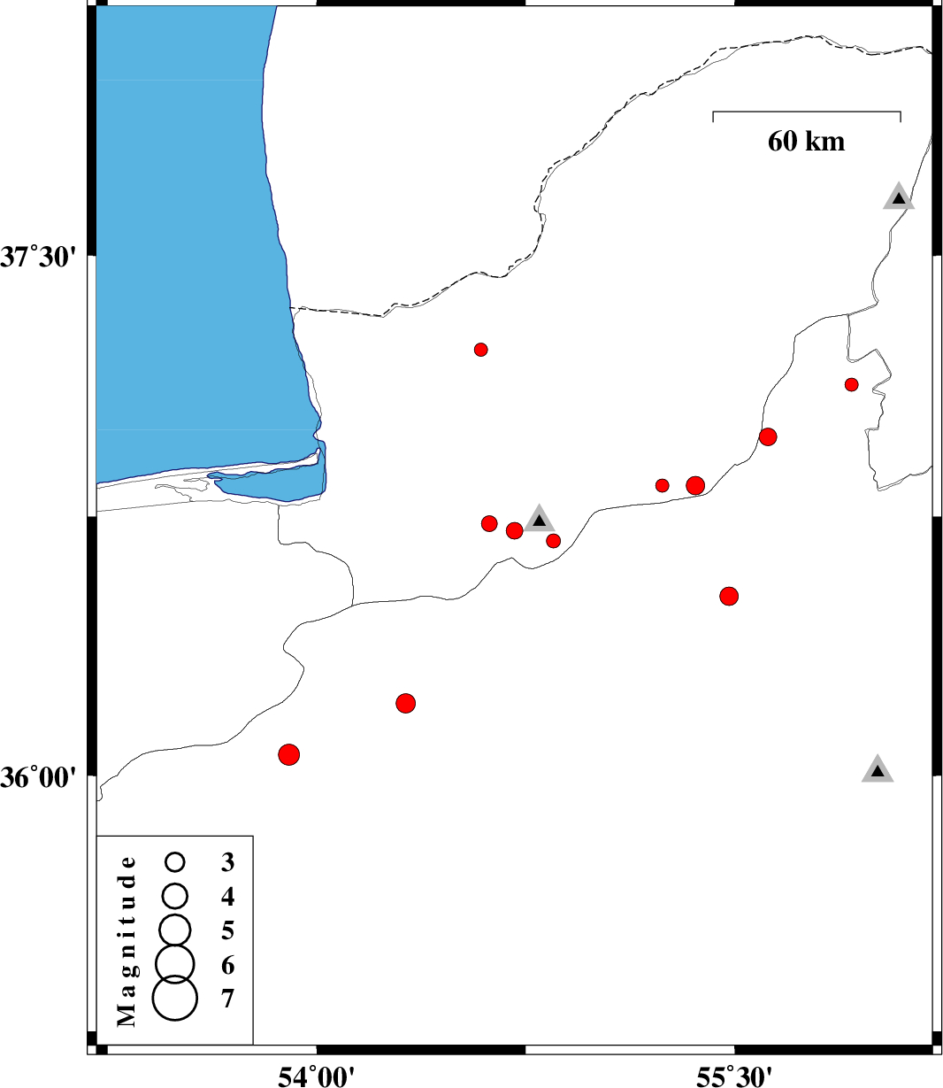
2012/06/02
|
14:38:22.3
|
19:08:22.3
| 36.71 | 54.71 | 14 |
ML:2.7
|
Golestan Province, 26 km South-West of Ali Abad | |
|
|
2012/05/27
|
18:31:14.6
|
23:01:14.6
| 36.68 | 54.85 | 14 |
ML:2.2
|
Golestan Province, 25 km South of Ali Abad | |
|
|
2012/05/26
|
09:36:54.6
|
14:06:54.6
| 37.13 | 55.92 | 40 |
ML:2.1
|
Semnan Province, 48 km South-East of Minodasht | |
|
|
2012/05/24
|
20:39:04.8
|
01:09:04.8
| 36.98 | 55.62 | 14 |
ML:2.8
|
Semnan Province, 35 km South-East of Minodasht | |
|
|
2012/05/24
|
18:48:00.2
|
23:18:00.2
| 36.06 | 53.9 | 15 |
ML:3.4
|
Semnan Province, 42 km South-West of Damghan | |
|
|
2012/05/22
|
15:55:55.6
|
20:25:55.6
| 36.73 | 54.62 | 31 |
ML:2.5
|
Golestan Province, 20 km South-East of Gorgan | |
|
|
2012/05/18
|
04:34:45.3
|
09:04:45.3
| 36.21 | 54.32 | 38 |
ML:3.1
|
Semnan Province, 6 km Damghan | |
|
|
2012/05/17
|
23:41:14.8
|
04:11:14.8
| 37.23 | 54.59 | 16 |
ML:2.1
|
Golestan Province, 27 km North-East of Aq Qaleh | |
|
|
2012/05/17
|
12:57:56.9
|
17:27:56.9
| 35.47 | 53.29 | 14 |
ML:2.8
|
Semnan Province, 14 km West of Semnan | |
|
|
2012/05/17
|
07:51:20.6
|
12:21:20.6
| 36.84 | 55.36 | 8 |
ML:2.9
|
Golestan Province, 27 km South-East of Ramian | |
|
|
2012/05/17
|
01:18:57.9
|
05:48:57.9
| 36.52 | 55.48 | 14 |
ML:3
|
Semnan Province, 47 km North-East of Shahrud | |
|
|
2012/05/11
|
07:45:05.8
|
12:15:05.8
| 35.5 | 53.21 | 16 |
ML:2.9
|
Semnan Province, 19 km West of Semnan | |
|
|
2012/05/10
|
04:21:42.5
|
08:51:42.5
| 36.84 | 55.24 | 14 |
ML:2.1
|
Golestan Province, 21 km South of Ramian | |
|
|
2012/05/09
|
22:14:45.9
|
02:44:45.9
| 35.27 | 53.38 | 18 |
ML:2.4
|
Semnan Province, 33 km South of Semnan | |
|
|
2012/05/08
|
01:11:40.8
|
05:41:40.8
| 35.33 | 53.32 | 36 |
ML:3.9
|
Semnan Province, 28 km South of Semnan | |
|
|
2012/05/07
|
09:26:03.8
|
13:56:03.8
| 35.71 | 53.24 | 14 |
ML:2.7
|
Semnan Province, 22 km North-West of Semnan | |
|
|
2012/05/07
|
09:14:56.1
|
13:44:56.1
| 35.49 | 53.23 | 18 |
ML:2.6
|
Semnan Province, 18 km West of Semnan | |
|
|
2012/05/06
|
14:30:12.3
|
19:00:12.3
| 35.36 | 53.22 | 14 |
ML:3.4
|
Semnan Province, 29 km South-West of Semnan | |
