
| Prel. Rep. | Date | Time(UTC) | Time(Local) | Lat. | Lon. | Depth | Mag. | Region | Waveform |
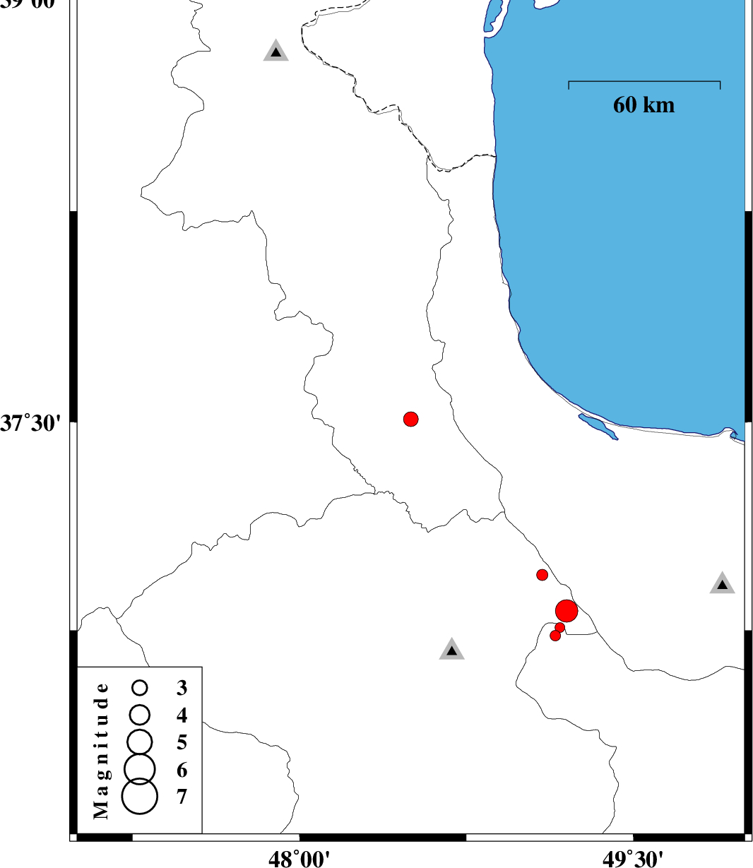
| 2012/03/23 | 20:55:55.4 | 01:25:55.4 | 36.73 | 49.15 | 18 | ML:2.1 | Ghazvin Province, 27 km West of Rudbar | ||
| 2012/03/23 | 05:13:08.1 | 09:43:08.1 | 37.51 | 48.5 | 14 | ML:3 | Ardebil Province, 13 km South of Khalkhal | ||
| 2012/03/18 | 20:47:43.6 | 00:17:43.6 | 36.76 | 49.17 | 15 | ML:2 | Ghazvin Province, 24 km West of Rudbar | ||
| 2012/03/18 | 02:38:16.3 | 06:08:16.3 | 36.82 | 49.2 | 14 | ML:4.5 | Zanjan Province, 20 km West of Rudbar | ||
| 2012/03/16 | 04:35:23.1 | 08:05:23.1 | 36.95 | 49.09 | 18 | ML:2.3 | Zanjan Province, 11 km East of Abbar |