
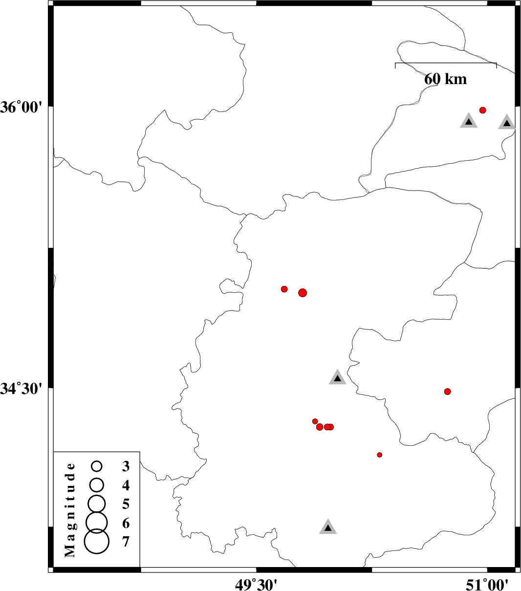
| Prel. Rep. | Date | Time(UTC) | Time(Local) | Lat. | Lon. | Depth | Mag. | Region | Waveform |
| 2012/02/23 | 23:00:44.1 | 02:30:44.1 | 34.29 | 49.96 | 6 | ML:1.8 | Markazi Province, 26 km South of Ashtiyan | ||
| 2012/02/23 | 22:55:46.7 | 02:25:46.7 | 35.03 | 49.68 | 14 | ML:1.8 | Markazi Province, 49 km North-West of Tafresh | ||
| 2012/02/23 | 04:09:14.8 | 07:39:14.8 | 35.01 | 49.8 | 14 | ML:2.4 | Markazi Province, 41 km North-West of Tafresh | ||
| 2012/02/21 | 20:54:24.6 | 00:24:24.6 | 34.48 | 50.74 | 27 | ML:1.8 | Qom Province, 23 km South-West of Qom | ||
| 2012/02/21 | 10:49:41.5 | 14:19:41.5 | 34.32 | 49.88 | 6 | ML:1.6 | Markazi Province, 26 km South-West of Ashtiyan | ||
| 2012/02/21 | 01:10:29.5 | 04:40:29.5 | 35.98 | 50.97 | 16 | ML:1.8 | Tehran Province, 20 km North of Karaj | ||
| 2012/02/20 | 17:40:07.4 | 21:10:07.4 | 34.29 | 49.98 | 6 | ML:1.9 | Markazi Province, 27 km South of Ashtiyan | ||
| 2012/02/20 | 10:46:02.7 | 14:16:02.7 | 34.14 | 50.3 | 6 | ML:1.4 | Markazi Province, 28 km North-West of Mahallat | ||
| 2012/02/18 | 05:26:35.9 | 08:56:35.9 | 34.29 | 49.91 | 6 | ML:2 | Markazi Province, 27 km South of Ashtiyan |