
| Prel. Rep. | Date | Time(UTC) | Time(Local) | Lat. | Lon. | Depth | Mag. | Region | Waveform |
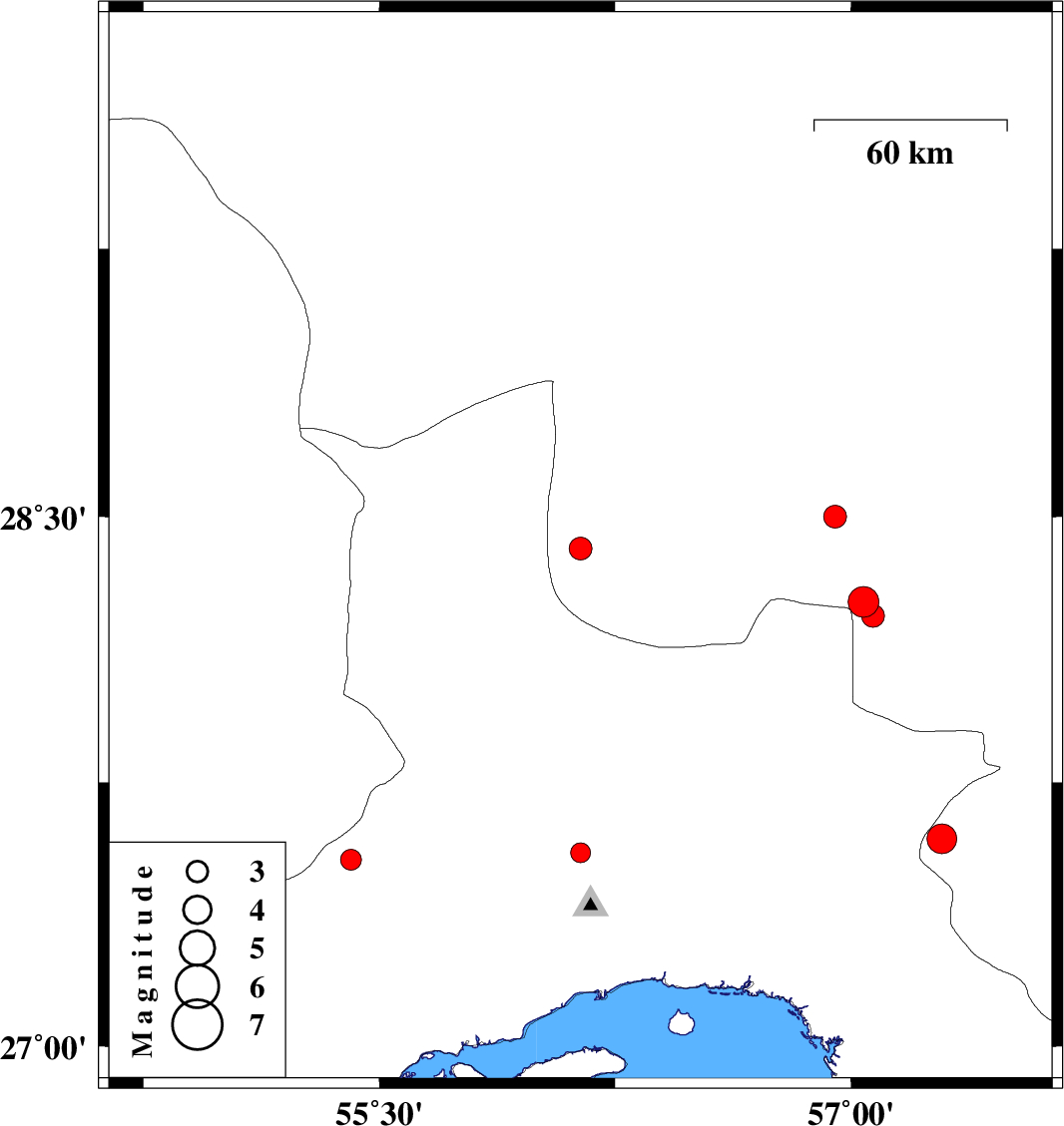
| 2011/12/01 | 03:33:08.6 | 07:03:08.6 | 28.41 | 56.14 | 17 | ML:3.2 | Kerman Province, 26 km North-East of Hajiabad | ||
| 2011/11/30 | 12:49:49.0 | 16:19:49.0 | 28.5 | 56.95 | 16 | ML:3.2 | Kerman Province, 79 km South-West of Jiroft | ||
| 2011/11/20 | 00:40:59.0 | 04:10:59.0 | 27.59 | 57.29 | 42 | ML:4.2 | Kerman Province, 19 km North of Dehbarez | ||
| 2011/11/13 | 14:11:06.8 | 17:41:06.8 | 28.26 | 57.04 | 14 | ML:4.4 | Kerman Province, 73 km North-West of Kahnuj | ||
| 2011/11/12 | 13:07:05.2 | 16:37:05.2 | 28.22 | 57.07 | 14 | ML:3.2 | Kerman Province, 68 km North-West of Kahnuj | ||
| 2011/11/11 | 13:21:24.3 | 16:51:24.3 | 27.55 | 56.14 | 14 | ML:2.8 | Hormozgan Province, 43 km North-West of Bandar-e abbas | ||
| 2011/11/07 | 22:04:58.8 | 01:34:58.8 | 27.53 | 55.41 | 14 | ML:2.9 | Hormozgan Province, 94 km North-West of Bandar-e abbas |