
| Prel. Rep. | Date | Time(UTC) | Time(Local) | Lat. | Lon. | Depth | Mag. | Region | Waveform |
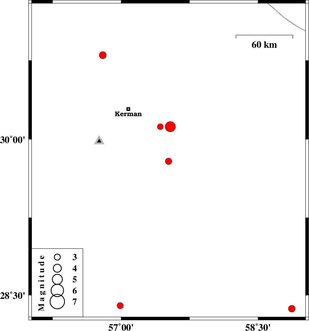
| 2011/06/26 | 19:46:58.6 | 00:16:58.6 | 30.12 | 57.54 | 16 | ML:5.1 | Kerman Province, 49 km South-East of Kerman | ||
| 2011/06/26 | 13:33:24.3 | 18:03:24.3 | 30.12 | 57.43 | 31 | ML:2.9 | Kerman Province, 39 km South-East of Kerman | ||
| 2011/06/26 | 09:50:28.0 | 14:20:28.0 | 29.79 | 57.52 | 9 | ML:3.3 | Kerman Province, 70 km South-East of Kerman | ||
| 2011/06/21 | 02:08:11.5 | 06:38:11.5 | 28.4 | 56.99 | 15 | ML:3.1 | Kerman Province, 80 km South-West of Jiroft | ||
| 2011/05/31 | 12:28:23.2 | 16:58:23.2 | 28.37 | 58.87 | 45 | ML:3.4 | Kerman Province, 96 km South-East of Bam | ||
| 2011/05/31 | 01:13:24.0 | 05:43:24.0 | 30.8 | 56.8 | 9 | ML:3.5 | Kerman Province, 22 km East of Zarand |