
Magnitude |
:3.4 |
| Date & Time (UTC) | 2011-05-31 12:28:23.2 |
| Date & Time (Local) | 1390/3/10 16:58:23.2 |
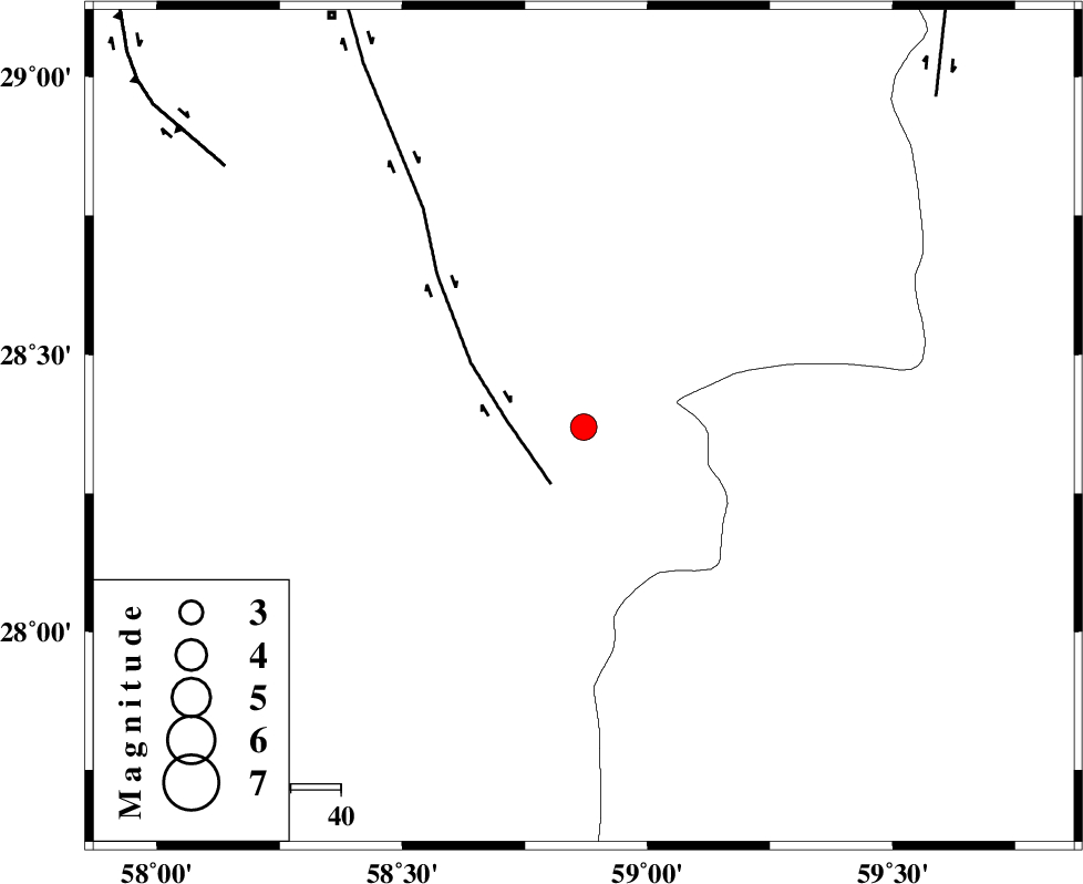
| Location | Lat:28.37 Lon: 58.87 |
| Region | Kerman Province, 96 km South-East of Bam |
Nearest Cities |
|
| 38 km South of Mohammadabad-e gonbaki, Kerman Province | |
| 42 km South West of Hoseynabad, Kerman Province | |
| 52 km North East of Borj-e abbasabad, Kerman Province | |
| 56 km South of Void, Kerman Province | |
| 65 km South East of Kruk, Kerman Province | |
| Depth | 45 km |
| Agency | |
Faults within 150 km: |
|
| BAM_F (Length: 118 km) , Distance to epicenter: 13 km | |
| GOWK_F (Length: 152 km) , Distance to epicenter: 88 km | |
| KANURAK_F (Length: 135 km) , Distance to epicenter: 96 km | |
| Number of Phases | 4 |
| RMS | 0 |
| Number of Stations | 3 |
| Error in Latitude | >3.6 km |
| Error in Longitude | 1.9 km |
| Error in Depth | 5 km |
Download waveform in seisan format
to download seisan software Click here
to access information about IIEES stations Click here
Amplitude | ||||||||
| UID | Agency | Station | Component | Amplitude | Period | Arrival Time | Proccessing Time | Signal Clip |
| 79186 | IIEES | KRBR | N | 161.2 | 0.29 | 2011-05-31 12:29:47 | 2011-05-31 12:51:00 | n |
| 79187 | IIEES | BNDS | E | 167.5 | 0 | 2011-05-31 12:29:40 | 2011-05-31 12:51:00 | n |
| 79188 | IIEES | BNDS | N | 178.6 | 0.66 | 2011-05-31 12:29:49 | 2011-05-31 12:51:00 | n |
Phase | ||||||||||||
| Agency | Station | Component | Phase Type | Phase Quality | First Motion | Observed Arrival Time | Time Residual | Loc. Flag | Input Weight | Distance | Azimuth | |
| IIEES | ZHSF | Z | Pg | E | 2011-05-31 12:29:00 | 0 | y | 231 | 53 | |||
| IIEES | KRBR | Z | Pn | E | 2011-05-31 12:29:02 | 0 | y | 272 | 312 | |||
| IIEES | KRBR | E | Sg | E | 2011-05-31 12:29:38 | 0 | y | 272 | 312 | |||
| IIEES | BNDS | Z | Pn | E | 2011-05-31 12:29:03 | 0 | y | 286 | 249 | |||