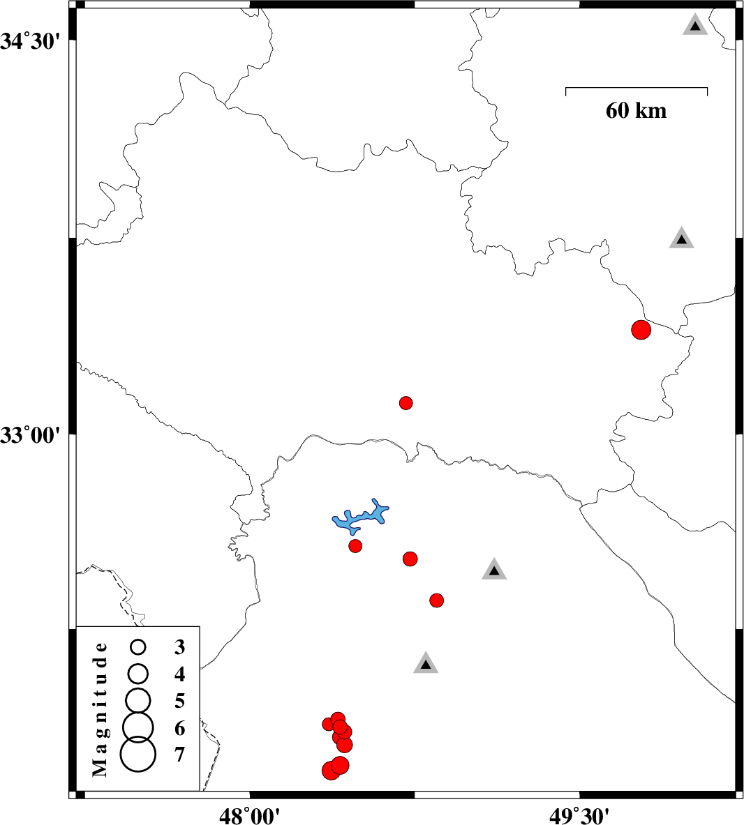
| Prel. Rep. | Date | Time(UTC) | Time(Local) | Lat. | Lon. | Depth | Mag. | Region | Waveform |
|
|
2011/05/26
|
01:02:55.2
|
05:32:55.2
| 33.12 | 48.71 | 14 |
ML:2.7
|
Lorestan Province, 51 km South-East of Khorramabad | |
|
|
2011/05/24
|
00:01:37.3
|
04:31:37.3
| 31.72 | 48.41 | 14 |
ML:3.7
|
Khoozestan Province, 28 km North-East of Susangerd | |
|
|
2011/05/19
|
12:01:43.0
|
16:31:43.0
| 32.36 | 48.85 | 14 |
ML:2.8
|
Khoozestan Province, 24 km West of Lali | |
|
|
2011/05/17
|
10:11:06.9
|
14:41:06.9
| 31.87 | 48.41 | 14 |
ML:3
|
Khoozestan Province, 40 km South-East of Shush | |
|
|
2011/05/17
|
02:56:42.7
|
07:26:42.7
| 31.9 | 48.4 | 15 |
ML:2.9
|
Khoozestan Province, 36 km South-East of Shush | |
|
|
2011/05/17
|
00:43:28.7
|
05:13:28.7
| 31.88 | 48.36 | 14 |
ML:2.7
|
Khoozestan Province, 37 km South-East of Shush | |
|
|
2011/05/15
|
21:09:33.9
|
01:39:33.9
| 31.85 | 48.43 | 14 |
ML:3
|
Khoozestan Province, 40 km North-East of Susangerd | |
|
|
2011/05/15
|
13:41:00.2
|
18:11:00.2
| 31.7 | 48.37 | 14 |
ML:3.8
|
Khoozestan Province, 24 km North-East of Susangerd | |
|
|
2011/05/15
|
13:32:13.3
|
18:02:13.3
| 31.8 | 48.43 | 14 |
ML:3.2
|
Khoozestan Province, 36 km North-East of Susangerd | |
|
|
2011/05/14
|
09:43:40.4
|
14:13:40.4
| 32.52 | 48.73 | 14 |
ML:3
|
Khoozestan Province, 36 km East of Andimeshk | |
|
|
2011/05/12
|
05:37:45.4
|
10:07:45.4
| 33.4 | 49.78 | 14 |
ML:3.9
|
Lorestan Province, 8 km Aligudarz | |
|
|
2011/05/11
|
09:52:01.0
|
14:22:01.0
| 31.83 | 48.41 | 14 |
ML:3.1
|
Khoozestan Province, 37 km North-East of Susangerd | |
|
|
2011/04/26
|
20:48:46.0
|
01:18:46.0
| 32.57 | 48.48 | 14 |
ML:2.7
|
Khoozestan Province, 17 km North-East of Andimeshk | |
