
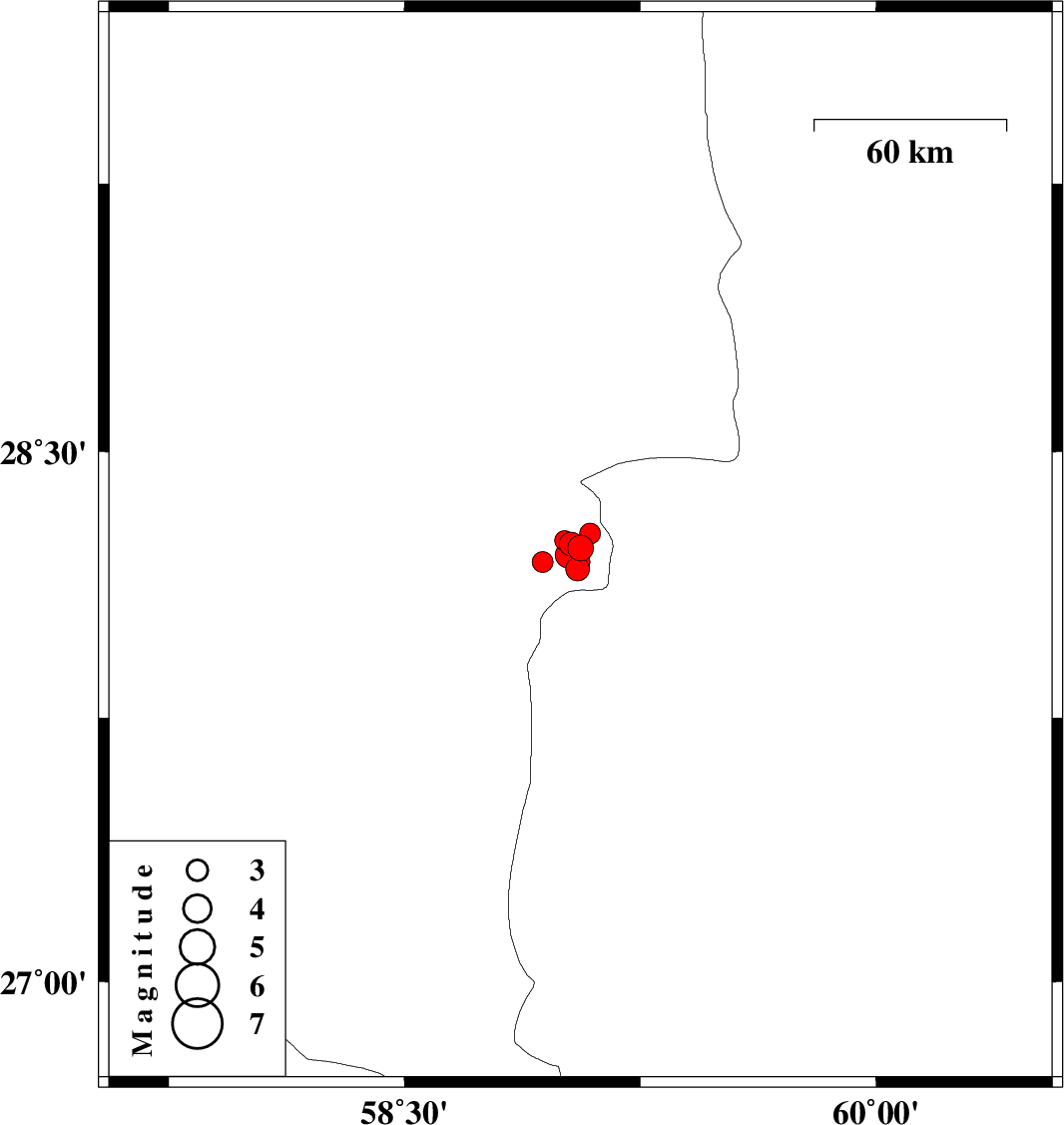
| Prel. Rep. | Date | Time(UTC) | Time(Local) | Lat. | Lon. | Depth | Mag. | Region | Waveform |
| 2011/02/18 | 08:56:33.0 | 12:26:33.0 | 28.23 | 59.06 | 18 | ML:3.7 | Kerman Province, 119 km South-East of Bam | ||
| 2011/02/16 | 01:32:42.4 | 05:02:42.4 | 28.19 | 58.94 | 14 | ML:3 | Kerman Province, 125 km North-East of Kahnuj | ||
| 2011/02/15 | 16:07:45.0 | 19:37:45.0 | 28.17 | 59.05 | 14 | ML:3.4 | Kerman Province, 135 km North-East of Kahnuj | ||
| 2011/02/13 | 03:57:50.7 | 07:27:50.7 | 28.27 | 59.09 | 14 | ML:3 | Kerman Province, 117 km South-East of Bam | ||
| 2011/02/13 | 01:34:20.0 | 05:04:20.0 | 28.19 | 59.06 | 14 | ML:2.7 | Kerman Province, 137 km North-East of Kahnuj | ||
| 2011/02/12 | 09:45:11.3 | 13:15:11.3 | 28.24 | 59.03 | 14 | ML:3.4 | Kerman Province, 117 km South-East of Bam | ||
| 2011/02/12 | 00:09:56.4 | 03:39:56.4 | 28.25 | 59.01 | 18 | ML:2.8 | Kerman Province, 115 km South-East of Bam | ||
| 2011/02/11 | 05:59:57.8 | 09:29:57.8 | 28.21 | 59.02 | 14 | ML:3.7 | Kerman Province, 119 km South-East of Bam |