
Magnitude |
:3.7 |
| Date & Time (UTC) | 2011-02-11 05:59:57.8 |
| Date & Time (Local) | 1389/11/22 09:29:57.8 |
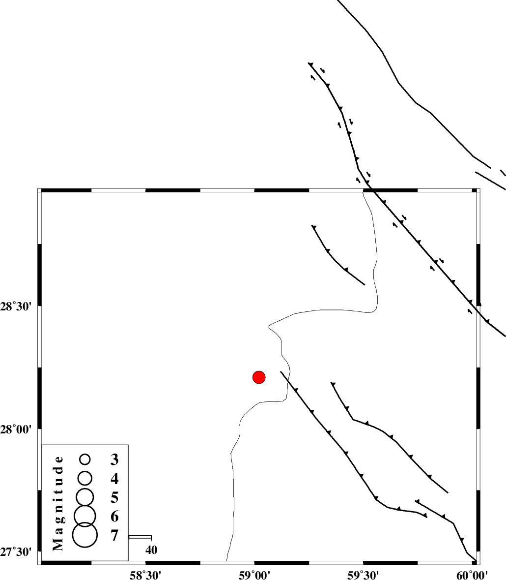
| Location | Lat:28.21 Lon: 59.02 |
| Region | Kerman Province, 119 km South-East of Bam |
Nearest Cities |
|
| 54 km North East of Borj-e abbasabad, Kerman Province | |
| 55 km South of Hoseynabad, Kerman Province | |
| 58 km South East of Mohammadabad-e gonbaki, Kerman Province | |
| 74 km South East of Void, Kerman Province | |
| 84 km South East of Fahroj, Kerman Province | |
| Depth | 14 km |
| Agency | |
Faults within 150 km: |
|
| BAM_F (Length: 118 km) , Distance to epicenter: 22 km | |
| KANURAK_F (Length: 135 km) , Distance to epicenter: 101 km | |
| GOWK_F (Length: 152 km) , Distance to epicenter: 111 km | |
| Number of Phases | 6 |
| RMS | 0.1 |
| Number of Stations | 4 |
| Error in Latitude | >2.1 km |
| Error in Longitude | 2.8 km |
| Error in Depth | 5.8 km |
Download waveform in seisan format
to download seisan software Click here
to access information about IIEES stations Click here
Amplitude | ||||||||
| UID | Agency | Station | Component | Amplitude | Period | Arrival Time | Proccessing Time | Signal Clip |
| 77880 | IIEES | BNDS | N | 330.9 | 0.44 | 2011-02-11 06:01:27 | 2011-02-11 06:27:00 | n |
| 77881 | IIEES | BNDS | E | 279.4 | 0.44 | 2011-02-11 06:01:28 | 2011-02-11 06:27:00 | n |
| 77882 | IIEES | KRBR | N | 286.9 | 0.56 | 2011-02-11 06:01:28 | 2011-02-11 06:27:00 | n |
Phase | ||||||||||||
| Agency | Station | Component | Phase Type | Phase Quality | First Motion | Observed Arrival Time | Time Residual | Loc. Flag | Input Weight | Distance | Azimuth | |
| IIEES | ZHSF | Z | Pn | E | 2011-02-11 06:00:34 | -0.1 | y | 232 | 47 | |||
| IIEES | BNDS | Z | Pn | E | 2011-02-11 06:00:42 | 0.1 | y | 294 | 253 | |||
| IIEES | BNDS | E | Sg | E | 2011-02-11 06:01:20 | -0.1 | y | 294 | 253 | |||
| IIEES | KRBR | Z | Pn | E | 2011-02-11 06:00:42 | 0.1 | y | 295 | 312 | |||
| IIEES | KRBR | N | Sg | E | 2011-02-11 06:01:21 | 0 | y | 295 | 312 | |||
| IIEES | GHIR | Z | Pn | E | 2011-02-11 06:01:19 | -0.1 | y | 592 | 272 | |||