
| Prel. Rep. | Date | Time(UTC) | Time(Local) | Lat. | Lon. | Depth | Mag. | Region | Waveform |
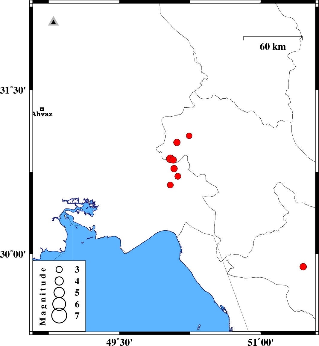
| 2010/06/07 | 06:00:27.8 | 10:30:27.8 | 30.86 | 50.07 | 35 | ML:3.3 | Kohkiluieh va boyerahmad Province, 34 km North-West of Behbahan | ||
| 2010/06/07 | 02:35:09.4 | 07:05:09.4 | 31.08 | 50.24 | 15 | ML:2.8 | Kohkiluieh va boyerahmad Province, 53 km North of Behbahan | ||
| 2010/06/07 | 02:28:10.2 | 06:58:10.2 | 30.87 | 50.04 | 26 | ML:3.8 | Kohkiluieh va boyerahmad Province, 34 km North-East of Omidiyeh | ||
| 2010/06/07 | 00:14:49.8 | 04:44:49.8 | 30.78 | 50.08 | 18 | ML:3.3 | Khoozestan Province, 26 km North-West of Behbahan | ||
| 2010/06/04 | 23:48:26.0 | 04:18:26.0 | 30.71 | 50.12 | 18 | ML:2.9 | Khoozestan Province, 17 km North-West of Behbahan | ||
| 2010/06/04 | 22:20:48.9 | 02:50:48.9 | 31.02 | 50.11 | 18 | ML:3.2 | Kohkiluieh va boyerahmad Province, 48 km North-West of Behbahan | ||
| 2010/06/02 | 18:56:19.8 | 23:26:19.8 | 30.63 | 50.04 | 33 | ML:3 | Khoozestan Province, 20 km West of Behbahan | ||
| 2010/06/01 | 08:25:41.0 | 12:55:41.0 | 29.88 | 51.45 | 15 | ML:3.2 | Fars Province, 27 km South of Nurabad |