
| Prel. Rep. | Date | Time(UTC) | Time(Local) | Lat. | Lon. | Depth | Mag. | Region | Waveform |
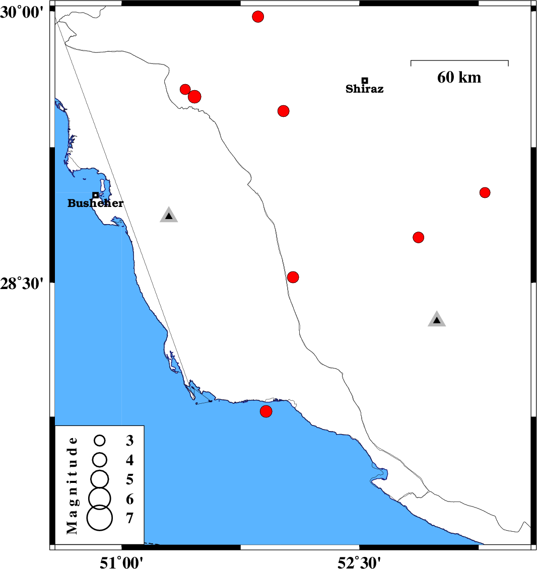
| 2009/10/12 | 23:41:41.8 | 03:11:41.8 | 28.53 | 52.08 | 6 | ML:3.3 | Fars Province, 38 km South of Farashband | ||
| 2009/10/10 | 12:18:06.2 | 15:48:06.2 | 29 | 53.29 | 37 | ML:2.9 | Fars Province, 35 km West of Fasa | ||
| 2009/10/09 | 19:14:42.1 | 22:44:42.1 | 27.78 | 51.91 | 15 | ML:3.4 | Persian Gulf, 16 km West of Bandar-e kangan | ||
| 2009/10/06 | 03:25:19.3 | 06:55:19.3 | 28.75 | 52.87 | 18 | ML:3.1 | Fars Province, 28 km East of Firuz Abad | ||
| 2009/09/28 | 23:27:05.6 | 02:57:05.6 | 29.57 | 51.4 | 18 | ML:3 | Fars Province, 25 km West of Kazerun | ||
| 2009/09/26 | 19:44:53.8 | 23:14:53.8 | 29.53 | 51.46 | 14 | ML:3.7 | Fars Province, 22 km West of Kazerun | ||
| 2009/09/24 | 04:10:09.3 | 07:40:09.3 | 29.97 | 51.86 | 15 | ML:3.3 | Fars Province, 35 km South-West of Ardakan | ||
| 2009/09/22 | 06:33:42.9 | 10:03:42.9 | 29.45 | 52.02 | 15 | ML:3.2 | Fars Province, 40 km South-East of Kazerun |