
| Prel. Rep. | Date | Time(UTC) | Time(Local) | Lat. | Lon. | Depth | Mag. | Region | Waveform |
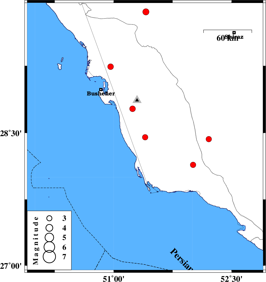
| 2010/03/15 | 20:03:08.6 | 23:33:08.6 | 28.45 | 51.4 | 39 | ML:3.3 | Bushehr Province, 23 km South of Khormog | ||
| 2010/03/14 | 12:38:15.4 | 16:08:15.4 | 28.14 | 52.01 | 24 | ML:3.3 | Bushehr Province, 35 km North of Bandar-e kangan | ||
| 2010/03/14 | 12:01:36.6 | 15:31:36.6 | 29.85 | 51.41 | 18 | ML:3.7 | Fars Province, 32 km South-West of Nurabad | ||
| 2010/03/03 | 06:56:32.5 | 10:26:32.5 | 28.77 | 51.24 | 15 | ML:3.4 | Bushehr Province, 12 km South of Ahram | ||
| 2010/02/25 | 15:41:50.0 | 19:11:50.0 | 29.24 | 50.96 | 15 | ML:3.4 | Bushehr Province, 24 km West of Borazjan | ||
| 2010/02/19 | 04:31:14.0 | 08:01:14.0 | 28.43 | 52.21 | 39 | ML:3.2 | 50 km South-East of Farashband, Fars Province |