| Prel. Rep. | Date | Time(UTC) | Time(Local) | Lat. | Lon. | Depth | Mag. | Region | Waveform |
|
|
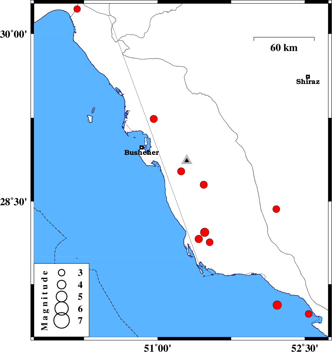
2010/03/03
|
06:56:32.5
|
10:26:32.5
| 28.77 | 51.24 | 15 |
ML:3.4
|
Bushehr Province, 12 km South of Ahram | |
|
|
2010/03/03
|
00:09:43.7
|
03:39:43.7
| 30.22 | 50.18 | 16 |
ML:3.1
|
Khoozestan Province, 42 km South of Behbahan | |
|
|
2010/02/25
|
15:41:50.0
|
19:11:50.0
| 29.24 | 50.96 | 15 |
ML:3.4
|
Bushehr Province, 24 km West of Borazjan | |
|
|
2010/02/19
|
04:31:14.0
|
08:01:14.0
| 28.43 | 52.21 | 39 |
ML:3.2
|
50 km South-East of Farashband, Fars Province | |
|
|
2010/02/11
|
19:40:52.2
|
23:10:52.2
| 28.13 | 51.53 | 29 |
ML:3.3
|
59 km South-East of Khormog, Bushehr Province | |
|
|
2010/02/11
|
08:09:57.2
|
11:39:57.2
| 28.16 | 51.42 | 18 |
ML:3.5
|
55 km South of Khormog, Bushehr Province | |
|
|
2010/02/07
|
18:40:06.2
|
22:10:06.2
| 28.65 | 51.47 | 14 |
ML:3.4
|
9 km Khormog, Bushehr Province | |
|
|
2010/02/05
|
05:57:06.6
|
09:27:06.6
| 27.56 | 52.22 | 7 |
ML:3.9
|
Persian Gulf, 32 km South of Jam | |
|
|
2010/02/04
|
23:40:08.6
|
03:10:08.6
| 27.48 | 52.54 | 20 |
ML:3.3
|
Persian Gulf, 35 km West of Mehr | |
|
|
2010/02/01
|
22:54:37.2
|
02:24:37.2
| 28.22 | 51.48 | 15 |
ML:3.9
|
48 km South-East of Khormog, Bushehr Province | |