| Prel. Rep. | Date | Time(UTC) | Time(Local) | Lat. | Lon. | Depth | Mag. | Region | Waveform |
|
|
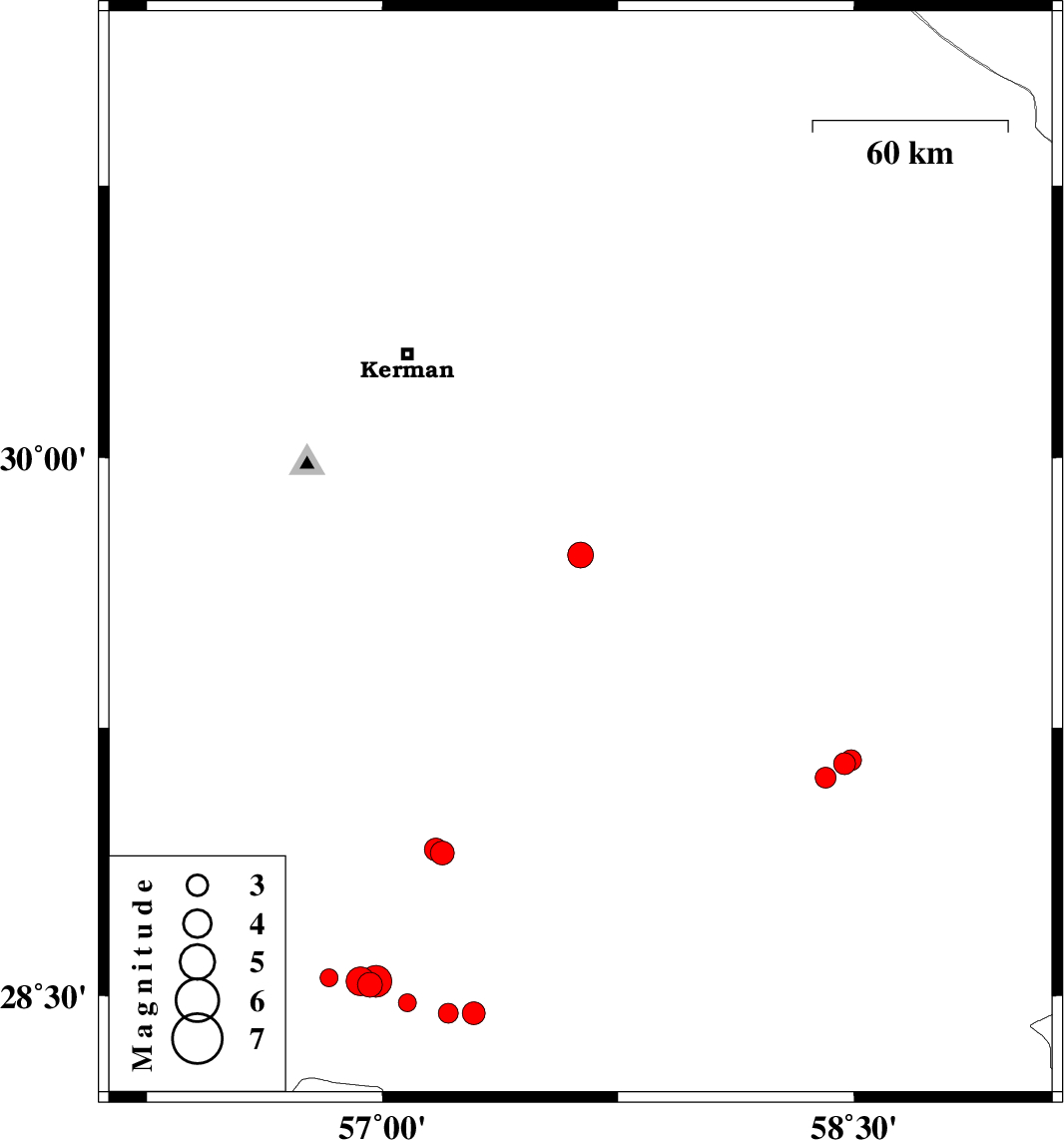
2004/12/10
|
19:02:54.2
|
22:32:54.2
| 29.73 | 57.63 | 18 |
ML:3.6
|
81 km South-East of Kerman, Kerman Province | |
|
|
2004/11/22
|
13:01:57.4
|
16:31:57.4
| 29.15 | 58.47 | 14 |
ML:3.1
|
11 km East of Bam, Kerman Province | |
|
|
2004/11/22
|
02:32:31.5
|
06:02:31.5
| 28.9 | 57.19 | 17 |
ML:3.4
|
59 km North-West of Jiroft, Kerman Province | |
|
|
2004/11/21
|
22:25:25.0
|
01:55:25.0
| 28.91 | 57.17 | 37 |
ML:3.3
|
61 km North-West of Jiroft, Kerman Province | |
|
|
2004/11/18
|
16:19:00.2
|
19:49:00.2
| 28.45 | 57.21 | 14 |
ML:2.8
|
57 km South-West of Jiroft, Kerman Province | |
|
|
2004/11/18
|
15:31:47.6
|
19:01:47.6
| 29.16 | 58.49 | 14 |
ML:2.9
|
14 km East of Bam, Kerman Province | |
|
|
2004/11/15
|
07:53:45.0
|
11:23:45.0
| 28.48 | 57.08 | 15 |
ML:2.6
|
67 km South-West of Jiroft, Kerman Province | |
|
|
2004/11/13
|
21:35:25.4
|
01:05:25.4
| 28.53 | 56.96 | 25 |
ML:3.5
|
77 km South-West of Jiroft, Kerman Province | |
|
|
2004/11/12
|
02:12:30.7
|
05:42:30.7
| 28.55 | 56.83 | 38 |
ML:2.5
|
79 km South-East of Baft, Kerman Province | |
|
|
2004/11/12
|
01:06:57.2
|
04:36:57.2
| 28.45 | 57.29 | 38 |
ML:3.2
|
50 km South-West of Jiroft, Kerman Province | |
|
|
2004/11/12
|
00:30:26.1
|
04:00:26.1
| 28.54 | 56.93 | 16 |
ML:4.1
|
80 km South-West of Jiroft, Kerman Province | |
|
|
2004/11/11
|
20:36:41.0
|
00:06:41.0
| 28.54 | 56.98 | 25 |
ML:4.5
|
75 km South-West of Jiroft, Kerman Province | |
|
|
2004/11/10
|
15:11:50.3
|
18:41:50.3
| 29.11 | 58.41 | 15 |
ML:2.9
|
5 km Bam, Kerman Province | |
