
| Prel. Rep. | Date | Time(UTC) | Time(Local) | Lat. | Lon. | Depth | Mag. | Region | Waveform |
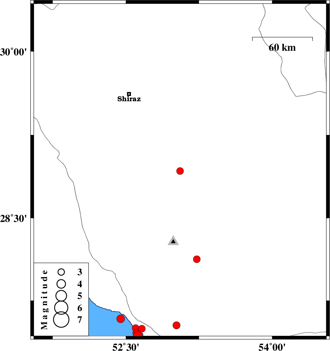
| 2026/02/15 | 14:07:15.7 | 17:37:15.7 | 27.492 | 52.664 | 12 | ML:3.3 | Bushehr Province, 23 km -West of Mehr | ||
| 2026/02/15 | 03:31:18.4 | 07:01:18.4 | 28.926 | 53.056 | 12 | ML:3.3 | Fars Province, 51 km North of Qir va Karzin | ||
| 2026/02/13 | 19:44:33.2 | 23:14:33.2 | 27.428 | 52.623 | 12 | ML:4.4 | , 29 km South-West of Mehr | ||
| 2026/02/13 | 17:34:26.4 | 21:04:26.4 | 27.454 | 52.608 | 12 | ML:3.4 | Persian Gulf, 29 km -West of Mehr | ||
| 2026/02/13 | 11:53:42.2 | 15:23:42.2 | 27.583 | 52.446 | 12 | ML:3.6 | Persian Gulf, 31 km South-East of Jam | ||
| 2026/02/08 | 12:48:58.3 | 16:18:58.3 | 27.498 | 52.6 | 12 | ML:3.3 | Bushehr Province, 29 km -West of Mehr | ||
| 2026/02/08 | 12:43:50.5 | 16:13:50.5 | 28.126 | 53.228 | 10 | ML:3.3 | Fars Province, 42 km South-East of Qir va Karzin | ||
| 2026/02/08 | 06:03:42.5 | 09:33:42.5 | 27.523 | 53.02 | 12 | ML:3.4 | Fars Province, 13 km -East of Mehr |