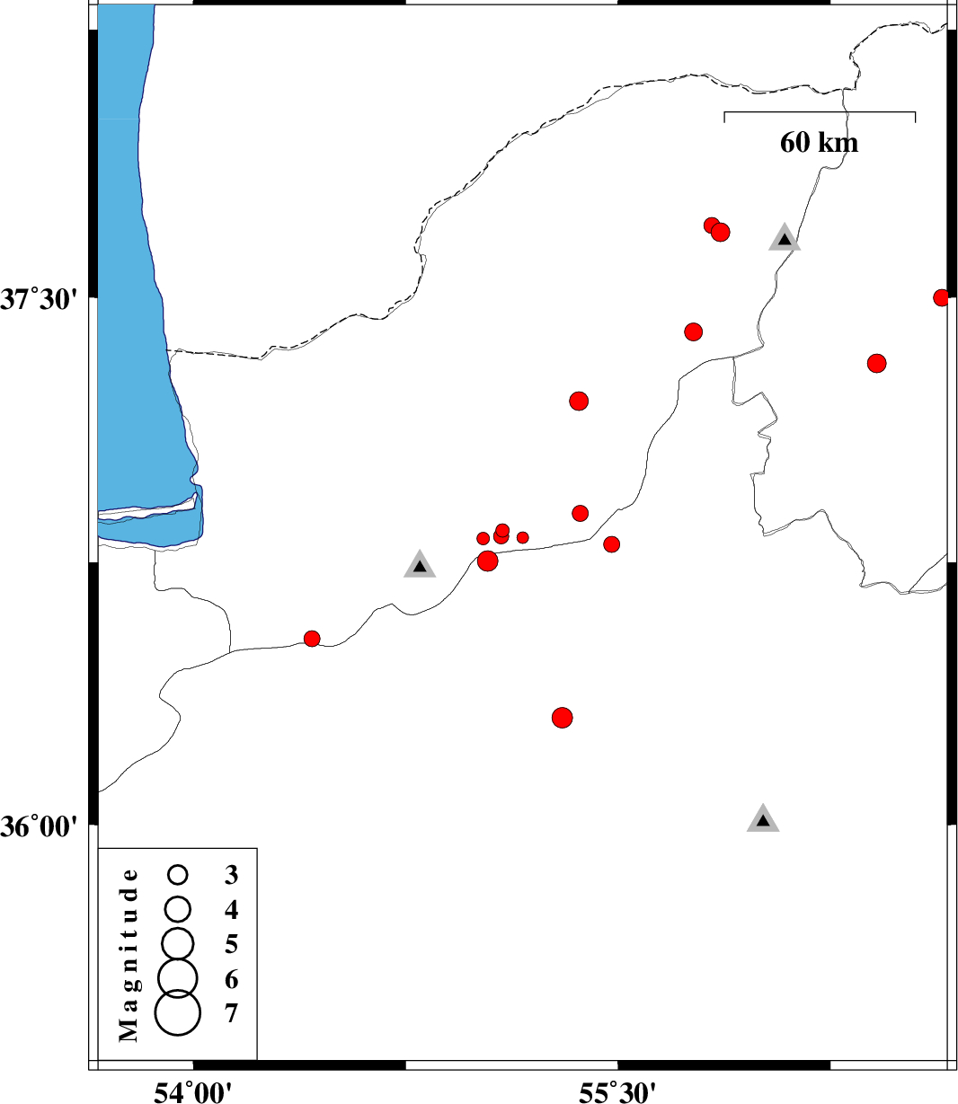
| Prel. Rep. | Date | Time(UTC) | Time(Local) | Lat. | Lon. | Depth | Mag. | Region | Waveform |
|
|
2015/11/15
|
08:04:28.0
|
11:34:28.0
| 36.82 | 55.163 | 16 |
ML:1.8
|
Golestan Province, 22 km South of Ramian | |
|
|
2015/11/15
|
07:32:26.5
|
11:02:26.5
| 36.818 | 55.023 | 14 |
ML:2
|
Golestan Province, 17 km -East of Ali Abad | |
|
|
2015/11/14
|
22:31:09.6
|
02:01:09.6
| 36.754 | 55.04 | 16 |
ML:3.2
|
Semnan Province, 23 km South-East of Ali Abad | |
|
|
2015/11/13
|
17:37:52.6
|
21:07:52.6
| 36.841 | 55.091 | 14 |
ML:2.1
|
Golestan Province, 20 km South of Ramian | |
|
|
2015/11/10
|
16:25:33.3
|
19:55:33.3
| 36.306 | 55.303 | 14 |
ML:3.2
|
Semnan Province, 33 km South-East of Shahrud | |
|
|
2015/11/10
|
01:08:08.9
|
04:38:08.9
| 36.824 | 55.087 | 7 |
ML:2.4
|
Golestan Province, 22 km South of Ramian | |
|
|
2015/11/07
|
21:12:16.5
|
00:42:16.5
| 36.801 | 55.478 | 7 |
ML:2.5
|
Semnan Province, 48 km South of Minodasht | |
|
|
2015/11/07
|
15:37:51.7
|
19:07:51.7
| 36.889 | 55.366 | 8 |
ML:2.5
|
Golestan Province, 24 km South-East of Ramian | |
|
|
2015/11/02
|
15:13:31.8
|
18:43:31.8
| 37.207 | 55.362 | 14 |
ML:3
|
Golestan Province, 3 km of Minodasht | |
|
|
2015/11/01
|
22:13:04.6
|
01:43:04.6
| 37.403 | 55.766 | 14 |
ML:2.8
|
Golestan Province, 24 km -East of Kalaleh | |
|
|
2015/10/31
|
00:56:36.7
|
04:26:36.7
| 36.532 | 54.419 | 14 |
ML:2.6
|
Golestan Province, 34 km South of Gorgan | |
|
|
2015/10/25
|
06:20:41.5
|
09:50:41.5
| 37.314 | 56.414 | 15 |
ML:3
|
Khorasan(north) Province, 40 km North of Jajarm | |
|
|
2015/10/24
|
21:18:31.8
|
00:48:31.8
| 37.499 | 56.645 | 14 |
ML:2.7
|
Khorasan(north) Province, 27 km -West of Ashkhaneh | |
|
|
2015/10/24
|
00:46:53.6
|
04:16:53.6
| 37.683 | 55.861 | 14 |
ML:3
|
Golestan Province, 47 km North-East of Kalaleh | |
|
|
2015/10/23
|
19:52:28.4
|
23:22:28.4
| 37.702 | 55.831 | 10 |
ML:2.5
|
Golestan Province, 47 km North-East of Kalaleh | |
